A Look at Alabama’s Weather at 6:35 p.m.
If you’re old like me, you remember the old radar summaries that used to be issued from the radar station in Centreville when there was a network WSR-57 radar there. They came out at :35 minutes past the hour.
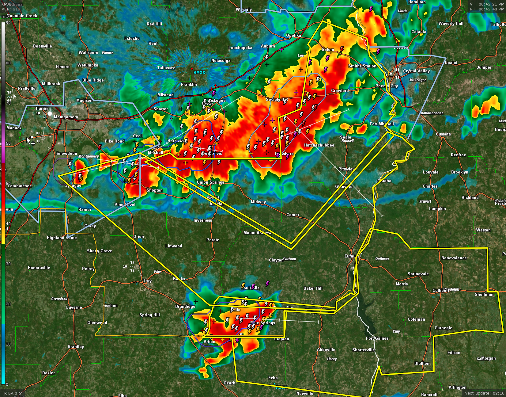
Severe thunderstorms continue pushing southeastward out of our southeastern counties at this time.
The NWS in Birmingham just issued a severe thunderstorm warning for southern Barbour County. That is for a new severe thunderstorm near Clio.
Warnings continue until 645 pm for parts of Lee and Macon Counties. Ahead of that, another severe thunderstorm warning continues for parts of Barbour, Bullock, Lee and Russell Counties.
The line of severe storms now extends from southeast of Opelika to Society Hill to Fort Davis, Mitchell and Pine Level.
The storms are pushing southeast at 30 mph. They will impact the remainder of Barbour County over the next hour.
In fact, The NWS Birmingham just issued a large severe thunderstorm warning for parts of Barbour, Bullock, Montgomery, Pike, and Russell Counties. It is in effect until 8 p.m.
This will be the last severe weather update of the early evening. Our friends in southeastern Central Alabama need to monitor these storms until they are out of the area. There could be a strong storm over the Tennessee Valley later tonight, but they seems unlikely now that the atmosphere has been worked over. Still, we will be watching.
Storms should be strong to severe again tomorrow afternoon and evening. Be prepared to monitor changing weather conditions during the day and check the blog for forecasts and updates.
Category: Alabama's Weather, ALL POSTS, Severe Weather
About the Author (Author Profile)
Bill Murray is the President of The Weather Factory. He is the site's official weather historian and a weekend forecaster. He also anchors the site's severe weather coverage. Bill Murray is the proud holder of National Weather Association Digital Seal #0001 @wxhistorianSubscribe
If you enjoyed this article, subscribe to receive more just like it.


