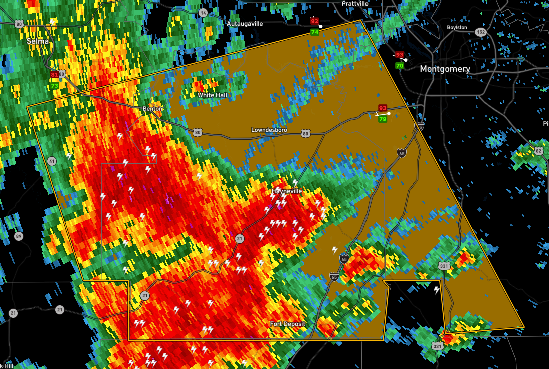
Severe Thunderstorm Warning for Autauga, Dallas, Lowndes, Montgomery
The National Weather Service in Birmingham has issued a
* Severe Thunderstorm Warning for…
Southeastern Autauga County in central Alabama…
Lowndes County in south central Alabama…
Southeastern Dallas County in south central Alabama…
Southwestern Montgomery County in south central Alabama…
* Until 215 PM CDT.
* At 126 PM CDT, severe thunderstorms were located along a line
extending from Benton to near Lowndes County Airport, moving east
at 30 mph.
HAZARD…60 mph wind gusts.
SOURCE…Radar indicated.
IMPACT…Expect damage to roofs, siding, and trees.
* Locations impacted include…
Southwestern Montgomery, Prattville, Fort Deposit, Mosses,
Hayneville, White Hall, Gordonville, Lowndesboro, Benton,
Beechwood, Tyler, Grady, Sellers, Davenport, Ramer, Pintlala,
Lowndes County Airport, Strata, Naftel and Hope Hull.
Category: Alabama's Weather, ALL POSTS, Severe Weather
About the Author (Author Profile)
Bill Murray is the President of The Weather Factory. He is the site's official weather historian and a weekend forecaster. He also anchors the site's severe weather coverage. Bill Murray is the proud holder of National Weather Association Digital Seal #0001 @wxhistorianSubscribe
If you enjoyed this article, subscribe to receive more just like it.


