Big Mass of Rain and Storms Pushing Across Alabama

Regional radars have been tracking a huge mass of rain and storms moving across much of the state of Mississippi this morning. The leading edge is now into west Alabama’s Lamar, Fayette, Pickens, Tuscaloosa, Sumter, Greene and moving into Hale county.
The heaviest activity is on that southern flank of the mass, with a good bit of lightning being reported now from the Tuscaloosa area back through much of Pickens County and into Greene County. The storms are not severe, but they could produce 40 mph wind gusts in addition to local flooding from the torrential rains, and of course, the deadly lightning.
Elsewhere, light to moderate rain covers parts of North Central and North Alabama, along the northern edge of the rani shield.
In eastern Mississippi, very heavy rain in the Scooba area, as well as much of Winston County MS around Philadelphia. This activity will also push into parts of Pickens, Greene, and Hale Counties in a couple of hours.
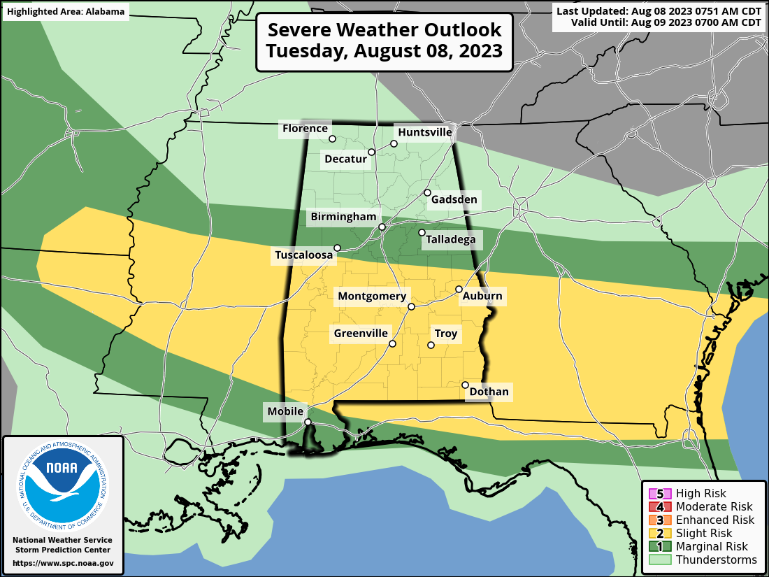
The storms may grow upscale with time too and the airmass over Alabama heats and destabilizes. The SPC does have areas from Birmingham south outlooked for a severe weather risk today. The greatest risk will be south of a line from Aliceville to Jemison to Rockford to Valley. Damaging winds will be the greatest threat.
Category: Alabama's Weather, ALL POSTS, Severe Weather
About the Author (Author Profile)
Bill Murray is the President of The Weather Factory. He is the site's official weather historian and a weekend forecaster. He also anchors the site's severe weather coverage. Bill Murray is the proud holder of National Weather Association Digital Seal #0001 @wxhistorianSubscribe
If you enjoyed this article, subscribe to receive more just like it.


