Severe Thunderstorm Warning for Bullock and Macon
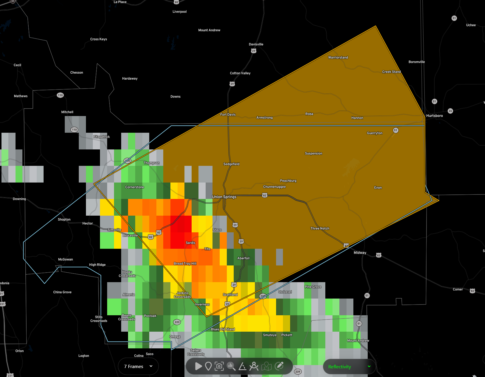
The National Weather Service in Birmingham has issued a
* Severe Thunderstorm Warning for…
Central Bullock County in southeastern Alabama…
Southeastern Macon County in southeastern Alabama…
* Until 545 PM CDT.
* At 458 PM CDT, a severe thunderstorm was located over Union
Springs, moving northeast at 25 mph.
HAZARD…60 mph wind gusts and quarter size hail.
SOURCE…Radar indicated.
IMPACT…Hail damage to vehicles is expected. Expect wind damage
to roofs, siding, and trees.
* Locations impacted include…
Union Springs, Guerryton, Aberfoil, Franklin Field, Creek Stand,
Warriorstand, Sedgefield, Three Notch and Fort Davis.
Category: ALL POSTS
About the Author (Author Profile)
Bill Murray is the President of The Weather Factory. He is the site's official weather historian and a weekend forecaster. He also anchors the site's severe weather coverage. Bill Murray is the proud holder of National Weather Association Digital Seal #0001 @wxhistorianSubscribe
If you enjoyed this article, subscribe to receive more just like it.


