Alabama Weather Update at 5 p.m.
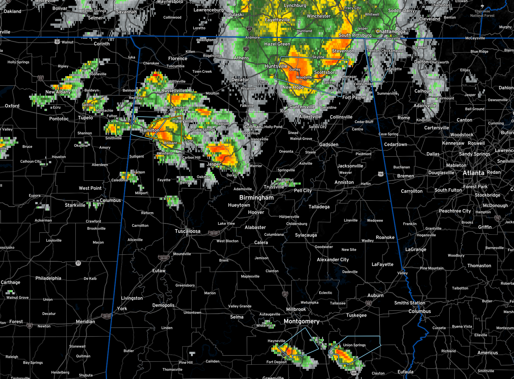
Severe thunderstorm warning continues for Marion County for a severe storm over the Hamilton area. Hail is approaching 1″ size. Damaging wind threat is high and the storm is exhibiting good structure. Low level helicity is less than 100 m2/s2 which should rule out tornado development.
Strong storms are exiting the Huntsville area now and will move across eastern Madison and Jackson Counties. Strong gusty winds and very heavy rain.
Storms have intensified across Franklin, Winston, and Walker Counties as well. But they are not severe at this time.
A strong storm in South Alabama is moving into Bullock County from Pike and Montgomery Counties. It will be impacting Union Springs. Expect 40 mph wind gusts.
The following counties were added to the severe thunderstorm watch: Cherokee, Etowah, Fayette, Lamar, and Walker. The watch continues for the rest of North and North Central Alabama until 8 p.m.
This round will go through this evening, with another round late tonight and more storms tomorrow afternoon.
Category: Alabama's Weather, ALL POSTS, Severe Weather
About the Author (Author Profile)
Bill Murray is the President of The Weather Factory. He is the site's official weather historian and a weekend forecaster. He also anchors the site's severe weather coverage. Bill Murray is the proud holder of National Weather Association Digital Seal #0001 @wxhistorianSubscribe
If you enjoyed this article, subscribe to receive more just like it.


