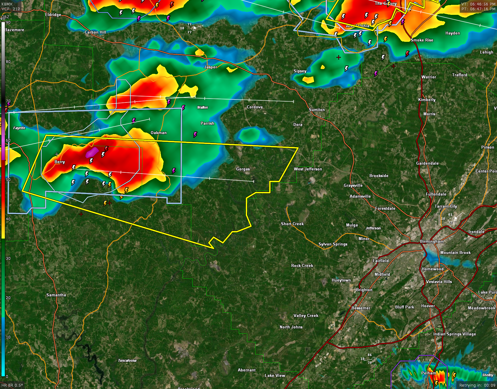
Severe Thunderstorm Warning for Walker, Tuscaloosa, and Fayette; Flood Advisory for Marion, Walker, and Winston
Severe storm near Berry is going to move toward Gorgas and northwestern Jefferson County…
Flooding is going to become likely in areas that have received repeated bouts of heavy rain.
The National Weather Service in Birmingham has issued a
* Severe Thunderstorm Warning for…
Southern Walker County in central Alabama…
North central Tuscaloosa County in west central Alabama…
Southeastern Fayette County in west central Alabama…
* Until 800 PM CDT.
* At 643 PM CDT, a severe thunderstorm was located over Berry, or 13
miles east of Fayette, moving east at 20 mph.
HAZARD…60 mph wind gusts and quarter size hail.
SOURCE…Radar indicated.
IMPACT…Hail damage to vehicles is expected. Expect wind damage
to roofs, siding, and trees.
* Locations impacted include…
Berry, Oakman, Boley Springs, Gorgas Steam Plant, Gorgas, Whitson,
Goodsprings, The Wye and Tutwiler.
Category: Alabama's Weather, ALL POSTS, Severe Weather
About the Author (Author Profile)
Bill Murray is the President of The Weather Factory. He is the site's official weather historian and a weekend forecaster. He also anchors the site's severe weather coverage. Bill Murray is the proud holder of National Weather Association Digital Seal #0001 @wxhistorianSubscribe
If you enjoyed this article, subscribe to receive more just like it.


