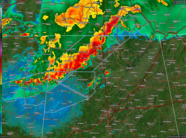
Update at 2:35 a.m.
Our line of strong thunderstorms continues pushing southeast at about 35-40 mph early this morning.
It extends from near Lynchburg in southern Tennessee to near Athens in Limestone County to Phil Campbell in Franklin County to Hamilton in Marion County back to near Smithville and Shannon in Mississippi.
A few cells have developed ahead of the main line over parts of Cullman and southeastern Winston Counties.
Additional storms are moving through northeastern Arkansas and the Memphis area.
No watches or warnings in effect for Alabama at this time. The storms are going to produce wind gusts to 50 mph, which can blow down limbs and weaker trees. Heavy rain is another impact, but lightning is limited to the cells over Marion, Lawrence and Limestone counties.
The storms should continue to be steady state or perhaps weaken slowly.
Category: Alabama's Weather, ALL POSTS, Severe Weather


