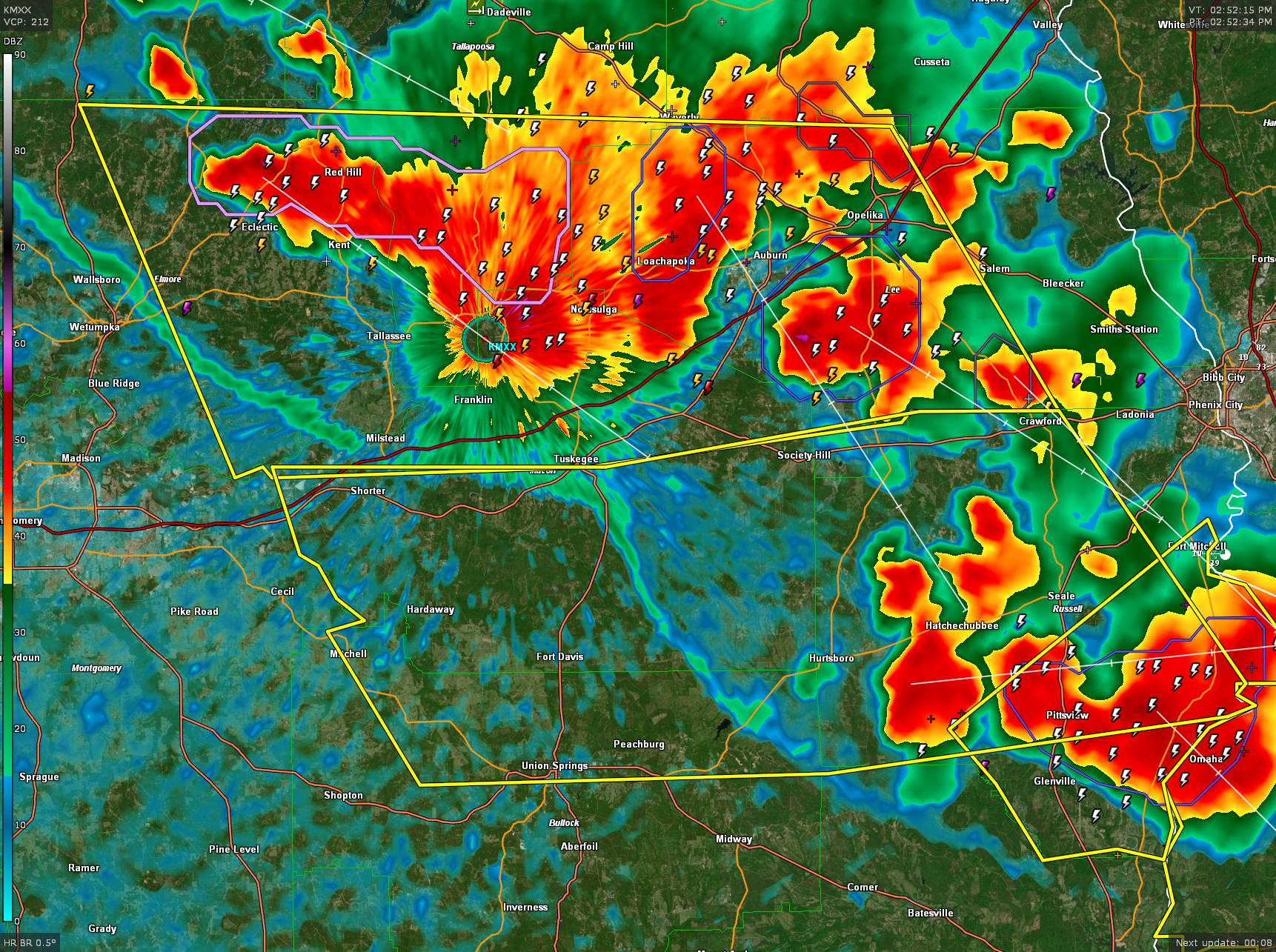
Severe Thunderstorm Waarning for Parts of Lee, Bullock, Macon, and Russell Counties
Wind is still a big threat with this storm. Lots of lightning too…nearly 70 flashes per minute.
Flooding is becoming a problem for Lee County. Flood advisory is in effect.
The National Weather Service in Birmingham has issued a
* Severe Thunderstorm Warning for…
South central Lee County in east central Alabama…
Northern Bullock County in southeastern Alabama…
Macon County in southeastern Alabama…
Russell County in southeastern Alabama…
* Until 400 PM CDT.
* At 251 PM CDT, severe thunderstorms were located along a line
extending from Eclectic to near Tuskegee to Opelika, moving
southeast at 35 mph.
HAZARD…60 mph wind gusts. This storm has a history of blowing
down trees.
SOURCE…Emergency management.
IMPACT…Expect damage to roofs, siding, and trees.
* Locations impacted include…
Tuskegee, Union Springs, Hurtsboro, Shorter, Uchee, Franklin Field,
Guerryton, Davisville, Liverpool, Russell County Sports Complex,
Seale, Hardaway, Tysonville, Victoryland, Society Hill,
Warriorstand, Fort Davis, Rutherford, Mitchell and Sedgefield.
Category: Alabama's Weather, ALL POSTS, Severe Weather
About the Author (Author Profile)
Bill Murray is the President of The Weather Factory. He is the site's official weather historian and a weekend forecaster. He also anchors the site's severe weather coverage. Bill Murray is the proud holder of National Weather Association Digital Seal #0001 @wxhistorianSubscribe
If you enjoyed this article, subscribe to receive more just like it.


