Severe Thunderstorm Warning for Bullock, Barbour, and Russell Counties
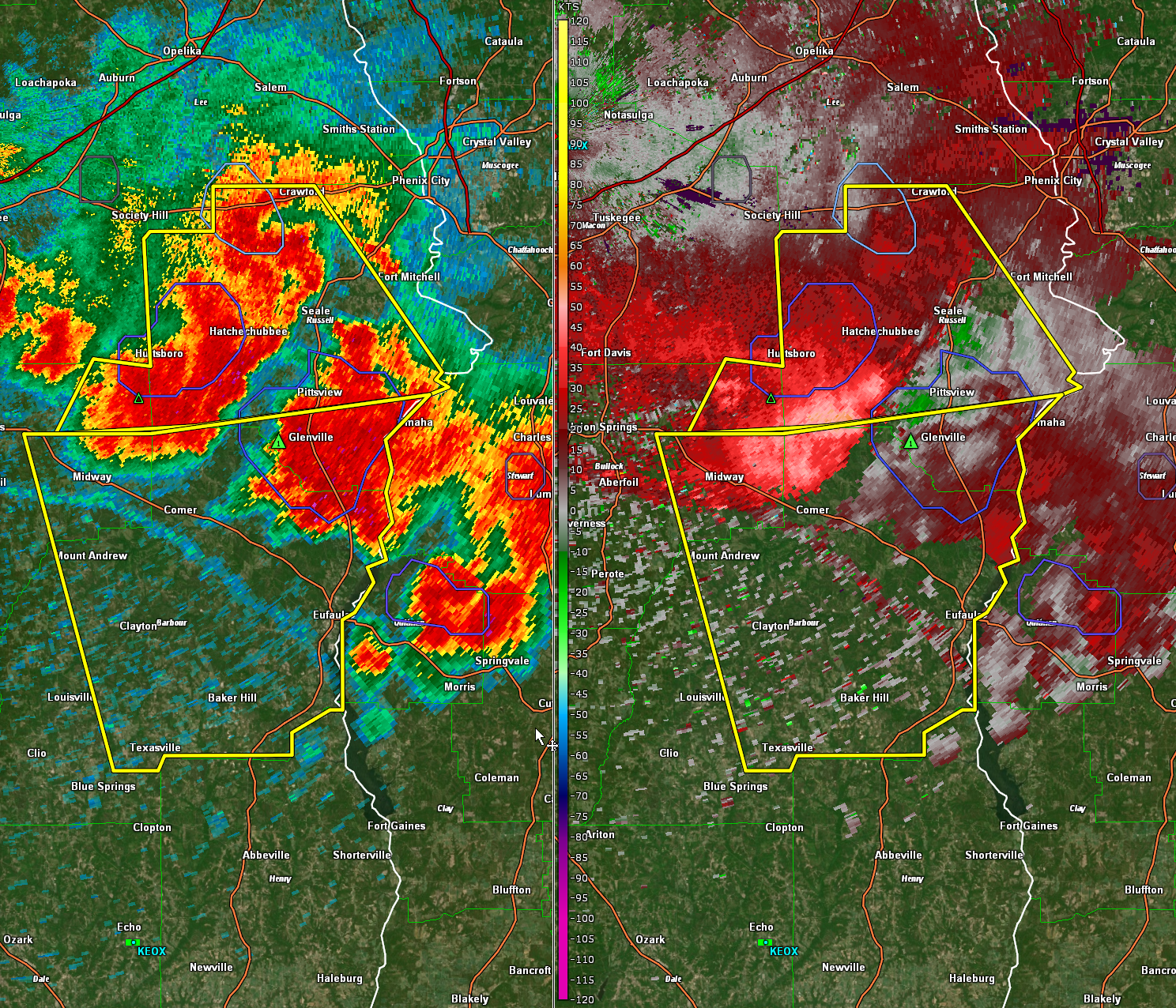
A large area of 55-60 mph winds is indicated south of Hurtsboro to Hatchechubbee. It is surging south toward Comer and Midway.
Hail is indicated west of Glenville. Some small hail is probably present in other parts of the storms in the area.
The National Weather Service in Birmingham has issued a
* Severe Thunderstorm Warning for…
East central Bullock County in southeastern Alabama…
Barbour County in southeastern Alabama…
Southern Russell County in southeastern Alabama…
* Until 430 PM CDT.
* At 325 PM CDT, a severe thunderstorm was located near Spring Hill,
or near Midway, moving southeast at 45 mph.
HAZARD…60 mph wind gusts.
SOURCE…Radar indicated.
IMPACT…Expect damage to roofs, siding, and trees.
* Locations impacted include…
Eufaula, Midway, Clayton, Hawkinsville, Spring Hill, Gaino, Comer,
Barbour County Public Lake Dam, Osco, Texasville, Richards
Crossroads, White Oak, Lakepoint Resort State Park, Millers Ford,
Batesville, Clayton Municipal Airport, Twin Springs, Lugo, Baker
Hill and Three Notch.
Category: Alabama's Weather, ALL POSTS, Severe Weather
About the Author (Author Profile)
Bill Murray is the President of The Weather Factory. He is the site's official weather historian and a weekend forecaster. He also anchors the site's severe weather coverage. Bill Murray is the proud holder of National Weather Association Digital Seal #0001 @wxhistorianSubscribe
If you enjoyed this article, subscribe to receive more just like it.


