Storms Moving Toward Northeast Alabama; Heat Advisories and Warnings in Effect As Well
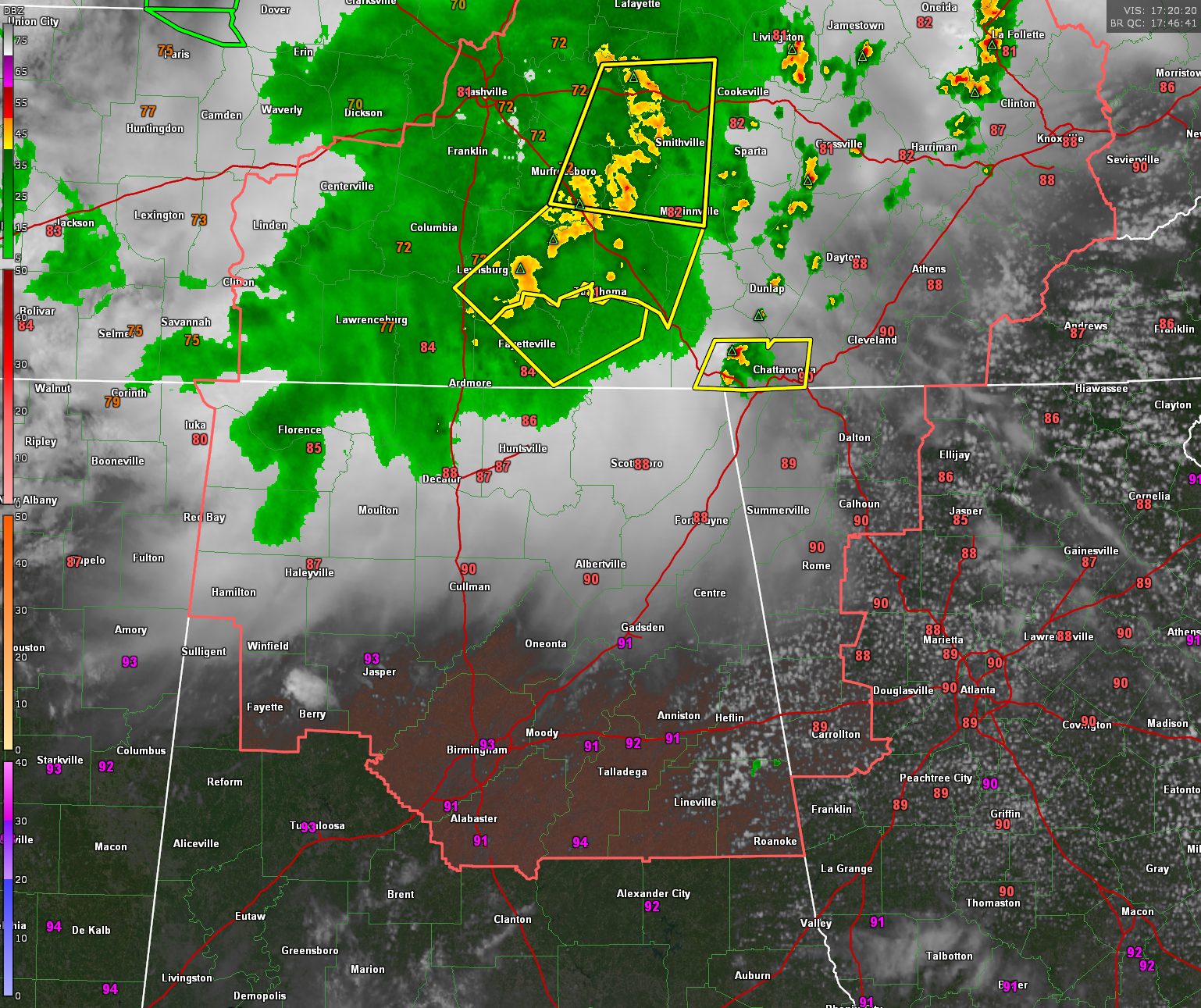
It has been a stormy day across Middle Tennessee. There have even been a couple of tornado warnings and a funnel cloud sighted near Franklin.
Right now, the storms the MCV extends from near Lebanon to east of Murfreesboro to Lewisburg.
Severe thunderstorm warnings are in effect all along the arc of storms.
Other storms are developing in eastern Tennessee ahead of this system. There is a severe thunderstorm warning in effect for the Chattanooga area.
We are concerned about the southwestern end of the MCV. Those storms will begin to affect northeastern Alabama in the next hour or so. This has been modelled fairly well by some of the convection allowing models.
We are also watching satellite trends in North Central Alabama along an old outflow boundary that has moved through northwestern Alabama, We can see growing cumulus clouds in parts of Fayette into Walker County but they haven’t managed to produce any thing on radar yet.
Be alert to rapidly changing weather conditions through the afternoon and into this evening across Alabama. Ares northeast of a line from Cherokee to Berry to Calera to Dadeville to Valley are included in an SPC Slight Risk outlook (Level 2 of 5) with a Marginal Risk south of a line from Aliceville to east of Montgomery to south of Phenix City.
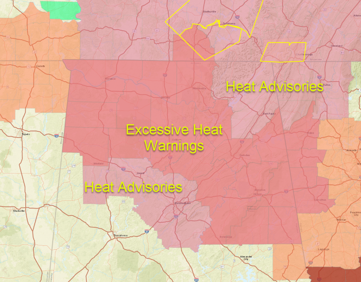
Don’t forget, before the storms arrive, Excessive Heat Warnings are in effect for areas of Northwest down through North Central and East Central Alabama including the Anniston, Gadsden, Cullman, Huntsville, Decatur Hamilton and Shoals areas. Heat advisories are in effect for the Fayette, Jasper and Birmingham areas.
Category: Alabama's Weather, ALL POSTS, Severe Weather
About the Author (Author Profile)
Bill Murray is the President of The Weather Factory. He is the site's official weather historian and a weekend forecaster. He also anchors the site's severe weather coverage. Bill Murray is the proud holder of National Weather Association Digital Seal #0001 @wxhistorianSubscribe
If you enjoyed this article, subscribe to receive more just like it.


