A Few Storms Forming: A Radar Update at 1:20 pm
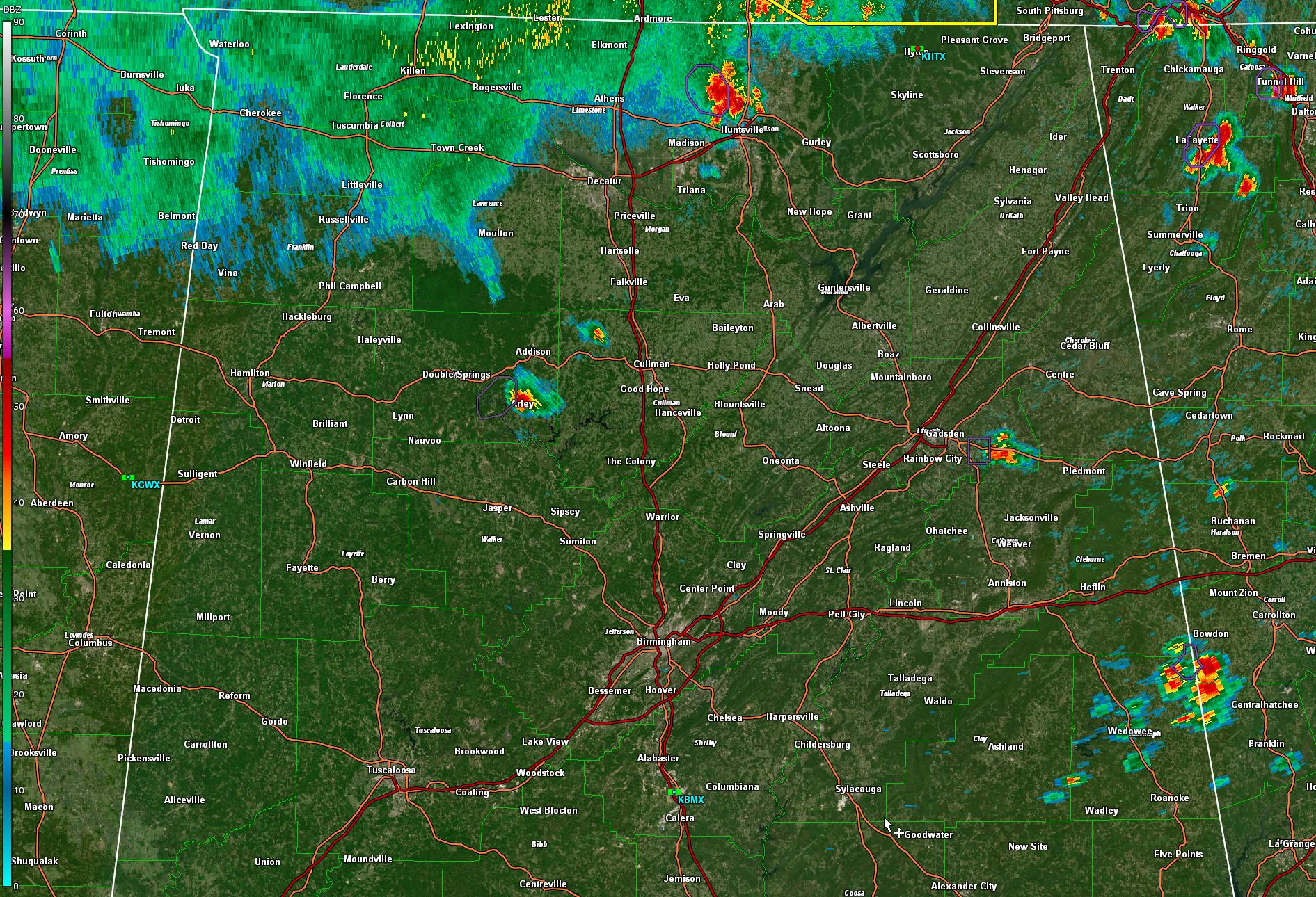
A strong storm has formed just northwest on Huntsville on that southwestern flanking line of the Tennessee storms.
Another is forming near Arley in eastern Winston County.
One is between Gadsden and Piedmont on US-278. A cluster of storms is over Randolph County in East Central Alabama. The strongest ones are on the Georgia border south of Bowdon. There are others forming aroudn Wedowee.
Low level lapse rates are marginal right now, but as the storms get established, they will be able to take advantage of steeper lapse rates the higher they grow.
As we mentioned in earlier post, the atmospheric instability is extreme today and the probability of damaging downbursts like those of yesterday is very high.
Category: Alabama's Weather, ALL POSTS, Severe Weather
About the Author (Author Profile)
Bill Murray is the President of The Weather Factory. He is the site's official weather historian and a weekend forecaster. He also anchors the site's severe weather coverage. Bill Murray is the proud holder of National Weather Association Digital Seal #0001 @wxhistorianSubscribe
If you enjoyed this article, subscribe to receive more just like it.


