Midday Nowcast: More Sun than Clouds
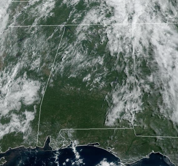
Mainly sunny and generally dry weather today, but there are a few isolated showers on the radar this afternoon. We will bring scattered showers and thunderstorms tomorrow night and into Thursday morning ahead of a surface front. Rain chances are in the 40-50% range, but a lot of locations will remain dry. On Thursday, drier air pushes into the state, and the chance of showers will be generally confined to the southern counties south of Montgomery. Friday will be a sunny day. Highs will be in the low 90s for most places today and tomorrow, and in the mid to upper 80s Thursday and Friday.
WEEKEND WEATHER: For now it looks dry for most of the state with mostly sunny days, fair nights, and highs in the mid to upper 80s, which are right at average for early September in Alabama. A few scattered showers will be possible near the Gulf Coast, but even there probably not much rain.
FOOTBALL WEATHER: The sky will be clear for the high school football games across Alabama Friday night with temperatures falling through the 70s.
Saturday, UAB will take on Georgia Southern in Statesboro, GA (5:00p CT kickoff)… the sky will be occasionally cloudy, and a passing shower or thunderstorm can’t be ruled out during the game. Temperatures will fall from near 90 degrees at kickoff through the 80s during the second half.
Alabama will host Texas Saturday evening at Bryant-Denny Stadium (6:00p CT kickoff)… the sky will be clear with temperatures falling from near 83 degrees at kickoff, into the 70s by the second half.
Auburn will be in Berkeley to take on the California Golden Bears (9:30p CT kickoff)… expect a clear sky with temperatures in the 60s during the game.
NEXT WEEK: Dry air will likely remain in place for much of next week with little risk of showers. Highs will hold in the 85-90 degree range most afternoons with lows in the 60s. Pretty routine mid-September weather for Alabama.
TROPICS: Invest 95L, is now Tropical Depression Thirteen and will likely become Lee later today or tonight. Forecast models develop this into a significant hurricane, perhaps the strongest of the season so far…we of course will keep an eye on it, but the global models turn the system to the north, east of the East Coast.
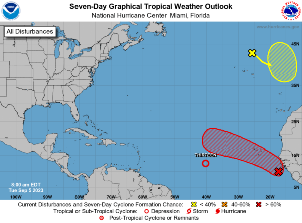
Another wave coming off the African Coast will likely develop as well, but it too should remain in the open waters of the Atlantic. This system will likely become Margot.
BEACH FORECAST CENTER: Get the latest weather and rip current forecasts for the beaches from Fort Morgan to Panama City on our Beach Forecast Center page. There, you can select the forecast of the region that you are interested in visiting.
WORLD TEMPERATURE EXTREMES: Over the last 24 hours, the highest observation outside the U.S. was 119.5F at Basrah-Hussen, Iraq. The lowest observation was -112.0F Vostok, Antarctica.
CONTIGUOUS TEMPERATURE EXTREMES: Over the last 24 hours, the highest observation was 111F at Rio Grande Village, TX. The lowest observation was 27F at Crestview, CA.
Category: Alabama's Weather, ALL POSTS
About the Author (Author Profile)
Macon, Georgia Television Chief Meteorologist, Birmingham native, and long time Contributor on AlabamaWX. Stormchaser. I did not choose Weather, it chose Me. College Football Fanatic. @Ryan_StinnetSubscribe
If you enjoyed this article, subscribe to receive more just like it.


