Saturday Weather Briefing – A Few Showers/Storms This Weekend for Parts of the Area
*** NO VIDEO TODAY… COMPUTER ISSUES ***
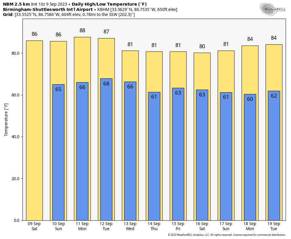
THIS WEEKEND: Troughing will develop today over the eastern parts of the country, and mix that with a surface low over Georgia and a cold front just to our south, there will be a chance of a few scattered showers and storms over the eastern half of the area. The western half looks to remain dry. Highs in the mid 80s to the lower 90s. Sunday looks to be almost exactly the same… A chance of scattered showers and storms over the eastern half of the area, while the western half remains dry. Highs in the mid 80s to the lower 90s.
NEXT WEEK: Monday and Tuesday will be dry days with plenty of sunshine, but clouds will begin to move in ahead of a cold front late on Tuesday evening. The parent surface low will be well off to our north, and at this point, moisture looks to be limited. A few isolated to scattered showers and storms will be possible Tuesday night through the day on Wednesday. Monday and Tuesday’s highs in the mid 80s to the lower 90s, but we’ll see upper 70s to the lower 90s on Wednesday.
Fall will be moving into Central Alabama on Thursday after the cold front, and we’ll have a drier and cooler airmass over the area. We’ll have a mix of sun and clouds, with highs in the mid 70s to the mid 80s. And at the end of the forecast period on Friday… Skies will be sunny and highs in the upper 70s to the upper 80s.
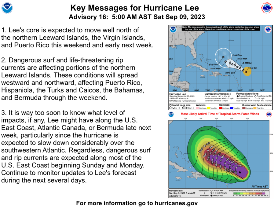
THE TROPICS: Major Hurricane Lee is barely hanging on to the major hurricane status, as the maximum winds have slowed to 115 mph due to strong wind shear. However, this looks to be a brief period of weakening as the NHC has Lee strengthening again with winds potentially as high as 140 mph (Cat. 4). By next Wednesday, the hurricane should gradually turn to the northwest and north-northwest in the flow between a trough over the eastern United States and the southwestern edge of the ridge. While the model guidance is in good agreement about the general synoptic setup, there remain differences in how far west Lee will move before it makes the turn.
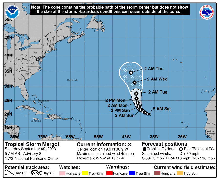
Tropical Storm Margot is currently move northwest over the open waters of the Atlantic Ocean, only pestering the fish. The forecast track shows that she will continue to do that as she will start to move more northward, becoming a hurricane by sometime on Monday. Margo will be no threat to land at this point, and she is only projected to reach category 1 status.
Category: Alabama's Weather, ALL POSTS, Tropical, Weather Xtreme Videos
About the Author (Author Profile)
Scott Martin is an operational meteorologist, professional graphic artist, musician, husband, and father. Not only is Scott a member of the National Weather Association, but he is also the Central Alabama Chapter of the NWA president. Scott is also the co-founder of Racecast Weather, which provides forecasts for many racing series across the USA. He also supplies forecasts for the BassMaster Elite Series events including the BassMaster Classic.Subscribe
If you enjoyed this article, subscribe to receive more just like it.


