Midday Nowcast: Plenty of Sunshine with a Few Afternoon Showers
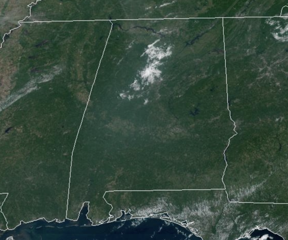
REST OF TODAY: Plenty of sunshine across the state today, and it remains hot, with highs in the upper 80s to lower 90s. A few afternoon showers are possible, mainly over our eastern counties. These will wind down quickly after sunset.
APPROACHING FRONT: Showers and storms should be a little more numerous tomorrow afternoon ahead of an approaching front. Highs tomorrow will be in the upper 80s. As the front sags south, cooler air slips into the state for the second half of the week. Highs Wednesday through Friday will be in the low to mid 80s over the northern counties, with upper 80s for South Alabama. The front will become nearly stationary, meaning we will maintain the chance of a few scattered showers daily, but nothing especially heavy or widespread.
WEEKEND & BEYOND: We will maintain the risk of a few showers over the weekend, but it certainly won’t be a wash-out, and the sun will be out at times. Rain chances this weekend will be in the 40-60% range. Highs will remain in the low 80s for North Alabama, with mid to upper 80s to the south. The pattern does not change much into next weekend, so for now, a persistence forecast will work best.
IN THE TROPICS: We have Hurricane Lee, Tropical Storm Margot, and a couple of other features off the African Coast. Next names up are Nigel and Ophelia.
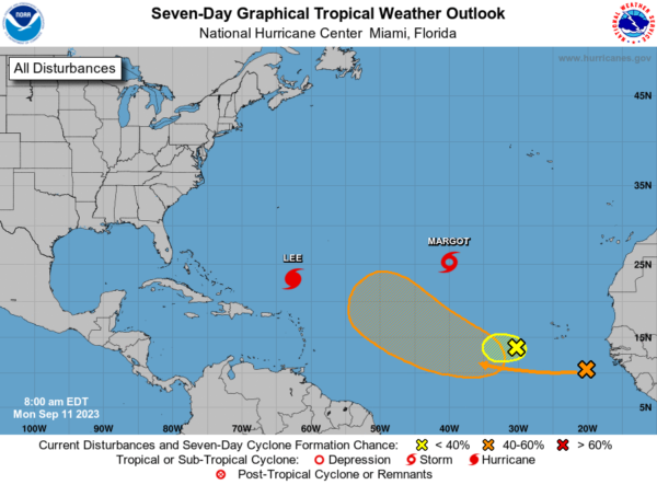
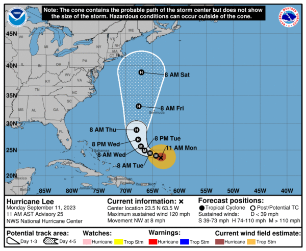
HURRICANE LEE: Lee is moving toward the northwest near 8 mph. A slow west-northwest to northwest motion is expected during the next couple of days, followed by turn toward the north by midweek. On the forecast track, Lee is expected to pass near, but to the west, of Bermuda in a few days. Maximum sustained winds remain near 120 mph with higher gusts. Lee is a category 3 hurricane on the Saffir-Simpson Hurricane Wind Scale. Some strengthening is forecast over the next day or so, followed by gradual weakening. Hurricane-force winds extend outward up to 75 miles from the center and tropical-storm-force winds extend outward up to 185 miles. The minimum central pressure based on data from the NOAA Hurricane Hunters is 948 mb (28.00 inches).
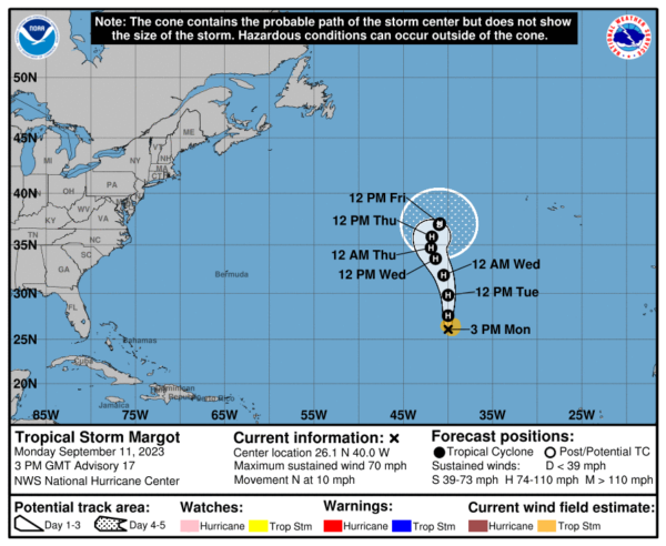
TROPICAL STORM MARGOT: Margot is moving toward the north near 10 mph, and this general motion is expected to continue during the next several days. Satellite estimates indicate that the maximum sustained winds of Margot have increased to near 70 mph with higher gusts. Margot is forecast to become a hurricane late today and could strengthen further over the next few days. Tropical-storm-force winds extend outward up to 105 miles from the center. The estimated minimum central pressure is 993 mb (29.33 inches).
BEACH FORECAST CENTER: Get the latest weather and rip current forecasts for the beaches from Fort Morgan to Panama City on our Beach Forecast Center page. There, you can select the forecast of the region that you are interested in visiting.
WORLD TEMPERATURE EXTREMES: Over the last 24 hours, the highest observation outside the U.S. was 120.2F at Omidieh, Iran. The lowest observation was -109.8F Vostok, Antarctica.
CONTIGUOUS TEMPERATURE EXTREMES: Over the last 24 hours, the highest observation was 113F at Coolidge, AZ. The lowest observation was 27F at Bynum, MT.
Category: Alabama's Weather, ALL POSTS
About the Author (Author Profile)
Macon, Georgia Television Chief Meteorologist, Birmingham native, and long time Contributor on AlabamaWX. Stormchaser. I did not choose Weather, it chose Me. College Football Fanatic. @Ryan_StinnetSubscribe
If you enjoyed this article, subscribe to receive more just like it.


