Saturday Weather Briefing — Summer-Like Weather on This First Day of Fall
THE FIRST WEEKEND OF FALL: We are starting off with very nice conditions this morning, but as we get into the afternoon hours, this first day of fall will actually feel a little more like summer. We’ll have plenty of sunshine with highs in the upper 80s to the lower 90s.
Almost the same story for Sunday… plenty of sunshine with very warm to hot temperatures. No rain is expected and highs will be in the upper 80s to the lower 90s.
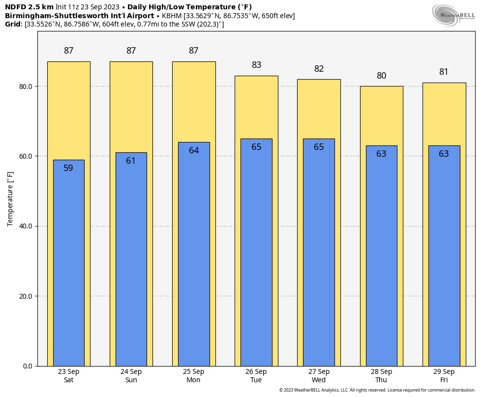
THE WORK WEEK AHEAD: On Monday, low pressure will be located just off to our west over Mississippi along a front that will stall out over Central Alabama. We’ll have a chance of some scattered shower activity through the afternoon and evening hours across the area, with a small chance continuing through the overnight hours. Highs will range from the lower 80s to the lower 90s.
We’ll keep those shower chances in the forecast for Tuesday as well as the front will not have moved very much to start. Eventually, the front will be pushed southward toward the end of the day. Highs in the 80s.
High pressure over the eastern seaboard will send an easterly flow across the area on Wednesday, that will keep temperatures cooler and will keep the chance of a few showers in the forecast. Highs in the upper 70s to the mid 80s.
Thursday will be much of a repeat of Wednesday’s weather as the wedge effect continues across Central Alabama. A few showers will be possible, but moisture levels will begin to decrease late in the day. Highs in the upper 70s to the mid 80s.
And at the end of the forecast period on Friday… While the wedge effect continues across the area, moisture levels will have dropped, and we’ll stay dry with mainly sunny skies. Highs in the upper 70s to the mid 80s.
THE TROPICS:
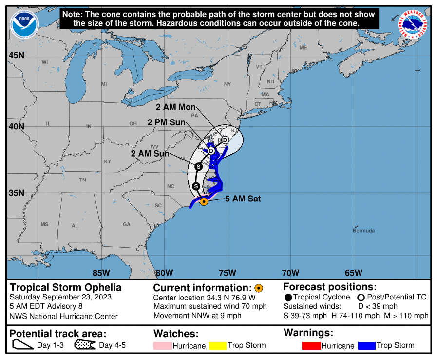
Tropical Storm Ophelia is making her way onshore this morning over North Carolina with maximum sustained winds just below hurricane strength at 70 mph. She will continue a north-northwesterly motion through today and will eventually curve back to the northeast while quickly weakening. Storm surge will continue for the coasts of North Carolina and Virginia, with some lower surge occurring possibly as far north as Delaware and New Jersey. We may see some flooding issues due to heavy rainfall this weekend across the Central Atlantic Region, along with life-threatening rip currents. Eventually, a front will absorb what is left of Ophelia and usher her back out to sea.
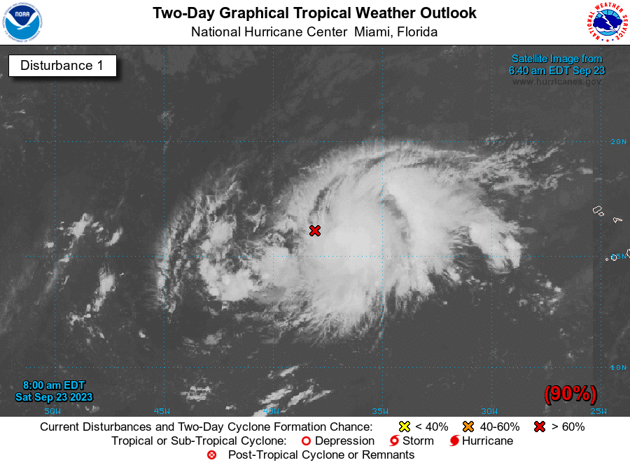
We also have a quickly organizing system out over the eastern Atlantic that should become a tropical depression today and most likely a tropical storm by Sunday. It will continue on a westward path through the weekend and eventually start a turn more to the northwest before midweek. The good news is that the models are showing this one curving away from any landmass and staying out over the open waters.
Category: Alabama's Weather, ALL POSTS, Tropical, Weather Xtreme Videos
About the Author (Author Profile)
Scott Martin is an operational meteorologist, professional graphic artist, musician, husband, and father. Not only is Scott a member of the National Weather Association, but he is also the Central Alabama Chapter of the NWA president. Scott is also the co-founder of Racecast Weather, which provides forecasts for many racing series across the USA. He also supplies forecasts for the BassMaster Elite Series events including the BassMaster Classic.Subscribe
If you enjoyed this article, subscribe to receive more just like it.


