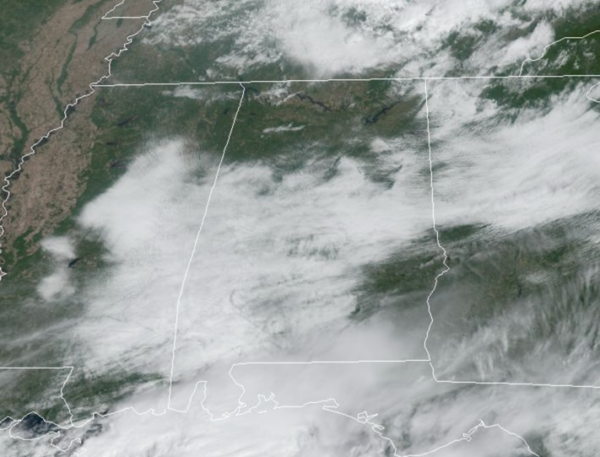
Midday Nowcast: Sun, Clouds, and Two Tropical Storms
TODAY THROUGH THE WEEKEND: Dry and warm weather highlights the forecast right on through the weekend as an upper-ridge builds in over the region. Highs will range from the low to upper 80s most days. Lows will generally be in the low 60s with cooler spots slipping into the upper 50s. Humidity levels will be low, so though it remains very warm, the comfort index is very tolerable across Alabama.
FOOTBALL WEATHER: The sky will be mostly fair for the high school football games across Alabama tomorrow night with temperatures falling through the 70s.
Saturday, UAB travels to New Orleans to take on Tulane (11:00a CT kickoff). The sky will be partly too mostly sunny with an outside risk of a brief shower or storm during the game. Temperatures will rise from near 84 at kickoff to 88 degrees by the final whistle.
Auburn hosts Georgia at Jordan-Hare Stadium (2:30p CT kickoff)… the sky will be mostly sunny. Temperatures will hover in the mid to upper 80s through most of the game.
And, Alabama will be in Starkville to take on Mississippi State (8:00p CT kickoff). Expect a clear sky with temperatures falling through the 70s.
RACE WEEKEND: Sunny warm days, fair nights at Talladega today through the weekend with highs in the 80s.
HELLO OCTOBER: The first week of my favorite month looks fairly routine for early fall and October in Alabama. Sunny, dry, and warm as the ridge will likely keep much of Alabama and the Deep South dry through the week with highs in the 80s. The prospect of a big rain event is looking low for at least the next 7-10 days. Remember is should be dry this time of year, October is statistically our driest month of the year in Alabama.
IN THE TROPICS: We continue to have Tropical Storm Philippe. Philippe is moving toward the west-northwest near 2 mph. A slow westward or southwestward motion is expected during the next few days. Maximum sustained winds are near 50 mph with higher gusts. Little change in strength is forecast during the next few days. Tropical-storm-force winds extend outward up to 175 miles from the center. The estimated minimum central pressure is 1002 mb (29.59 inches).
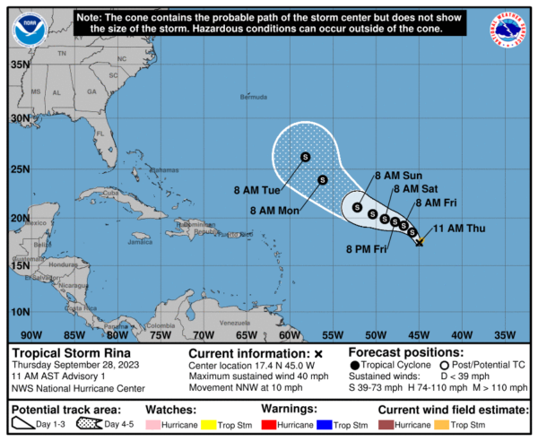
We now have Tropical Storm Rina. Rina is moving toward the north-northwest near 10 mph, and the storm is expected to turn more westward later today or tomorrow. Maximum sustained winds are near 40 mph with higher gusts. Some gradual strengthening is forecast during the next few days. Tropical-storm-force winds extend outward up to 60 miles from the center. The estimated minimum central pressure is 1005 mb (29.68 inches).
Remaining names on list this year are Sean, Tammy, Vince, and Whitney.
BEACH FORECAST CENTER: Get the latest weather and rip current forecasts for the beaches from Fort Morgan to Panama City on our Beach Forecast Center page. There, you can select the forecast of the region that you are interested in visiting.
WORLD TEMPERATURE EXTREMES: Over the last 24 hours, the highest observation outside the U.S. was 113.7F at Asswan, Egypt. The lowest observation was -82.5F Dome C, Antarctica.
CONTIGUOUS TEMPERATURE EXTREMES: Over the last 24 hours, the highest observation was 107F at Brawley, CA. The lowest observation was 19F at Mackay, ID.
Category: Alabama's Weather, ALL POSTS


