Saturday Weather Briefing — No Rain For the Next Seven Days
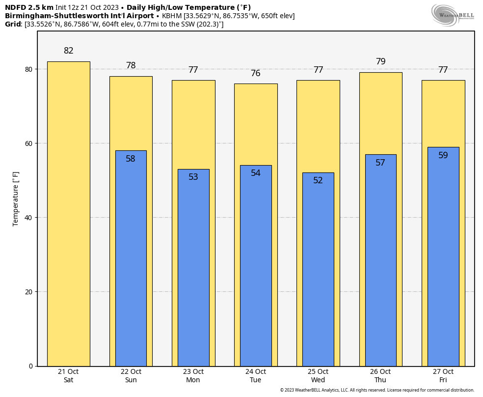
Today will start off with mostly sunny skies, but we’ll have a front move through the area later today and through tonight that will bring an increase in clouds. No rain is expected, and the afternoon highs will reach the mid 70s to the mid 80s. A Red Flag Warning has been issued for Blount, Calhoun, Cherokee, Cleburne, Etowah, Fayette, Jefferson, Lamar, Marion, Shelby, St. Clair, Talladega, and Walker counties as the combination of a dry air mass and breezy conditions will lead to critical fire weather conditions.
Clouds will continue to hang around on Sunday after the passage of the front that will block the sunshine at times. It will be partly cloudy with highs in the mid 70s to the lower 80s.
High pressure sets up just off the east coast on Monday, which will keep us dry and mild. We’ll have a good bit of sunshine with highs in the mid 70s to the lower 80s.
The high continues to be a shield for the southeast on Tuesday as it continues to keep disturbances out of the area. It will be sunny with highs in the mid to upper 70s.
Same story on Wednesday as we’ll continue to have sunny skies with highs in the mid 70s to the lower 80s.
On Thursday, the only thing that really changes is that we’ll have a few clouds floating over Central Alabama. We’ll be dry and mild with highs in the mid 70s to the lower 80s.
And at the end of the forecast period on Friday, there will be a front trying to approach the area from the west, but it will not make it as the high continues to deflect everything to our north. We’ll have a few clouds with highs in the upper 70s to the lower 80s.
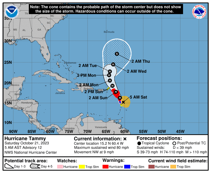
Hurricane Tammy is moving over the Windward Islands this morning with maximum sustained winds at 80 mph, bringing heavy rain, strong winds, dangerous surf, and life-threatening rip currents to those areas. A turn toward the north-northwest is forecast on Sunday, followed by a turn toward the north on Monday. On the forecast track, the center of Tammy will move near or over portions of the Leeward Islands through early Sunday, and then move north of the northern Leeward Islands by Sunday afternoon. After that, she’ll curve to the north-northeast and move out over the open waters of the western Atlantic Ocean.
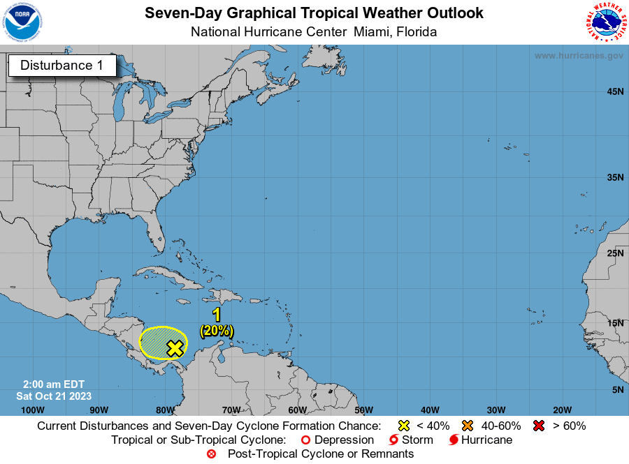
We also have a disturbance over the far southwestern Caribbean Sea that has a very small chance of development, but it will run out of time as it will make landfall over Central America by late Monday or early Tuesday.
Category: Alabama's Weather, ALL POSTS, Tropical, Weather Xtreme Videos
About the Author (Author Profile)
Scott Martin is an operational meteorologist, professional graphic artist, musician, husband, and father. Not only is Scott a member of the National Weather Association, but he is also the Central Alabama Chapter of the NWA president. Scott is also the co-founder of Racecast Weather, which provides forecasts for many racing series across the USA. He also supplies forecasts for the BassMaster Elite Series events including the BassMaster Classic.Subscribe
If you enjoyed this article, subscribe to receive more just like it.


