Sunday Weather Briefing Video: Fine Weather to Continue
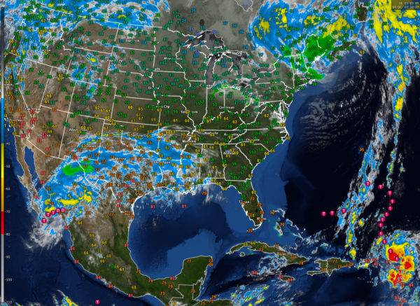
Saturday was a beautiful, warm fall day across North and Central Alabama. High temperatures across the area included 79F at Anniston, 83F at Birmingham, and 85F at Tuscaloosa. High clouds have been spreading across the area. They are emanating from Hurricane Norma, which made landfall yesterday afternoon in Mexico.
FOR YOUR SUNDAY: Those high clouds will continue spreading across the area today, even as a cold front moves through the area fairly unannounced. The only difference you will notice will be northerly winds behind the front, and slightly cooler temperatures. High temperatures will range from 72F in the North to 82F around Montgomery. Lows tonight will be in the upper 40s and lower 50s.
BEAUTIFUL WEEK AHEAD: After weeks and months of persistent troughs across the eastern half of the U.S., ridging will predominate our weather over the next week. High pressure over the Great Lakes will set up shop along the East Coast, ridging down into Alabama. This will lead to mostly sunny to partly cloudy skies each day, with highs in the upper 70s to lower 80s. Lows will be in the 50s.
WEEKEND OUTLOOK: The spell of dry weather will continue into the weekend. The warm weather will stay with us. Weekend highs will be in the 80s. Lows will be in the 60s.
NEXT RAIN CHANCES: It appears that the next chance of rain will come around the 30th or 31st. This looks like it will be a decent rain event, which is good news. The bad news is that it could affect trick or treating on Halloween.
VOODOO COUNTRY: The weekend of November 4th will feature much cooler conditions. Highs on Saturday and Sunday will be in the 50s and 60s.
BEACHCAST: An absolutely fabulous week is in store along the beautiful beaches of Alabama and Northwest Florida. Highs will be in the lower 80s each day, and lows will be in the middle 60s. Strong high pressure to the north will make things breezy at times, and this will lead to higher rip current risks, so please be careful. Water temperatures are still in the lower 70s.
Click here to see the Beach Forecast Center page.
IN THE TROPICS: Hurricane Tammy is clearing the islands of the northeastern Lesser Antilles after bringing hurricane force winds to Antigua and Barbuda yesterday evening. The hurricane passed just east of Guadeloupe keeping its core and strongest winds offshore. After passing Antigua and Barbuda, the hurricane brushed the islands of St. Martin/St. Maarten and Anguilla overnight. The prevailing wisdom is that the hurricane will turn to the north and northeast away from the Caribbean, keeping it well east of Bermuda. But the GFS has been hinting that an over the top ridge might block its forward progress. Not enough to bring it back into the East Coast of the United States, but perhaps enough to pose a threat to Bermuda, and certainly an opportunity to pad the seasonal ACE score. In fact, the GFS thinks it might still be around in 2 weeks! Only two more names to go on the list. Will we use them all? Will we have to go to the auxiliary names list? Don’t be surprised to see a system in the western Caribbean during the next two weeks.
ON THE PACIFIC SIDE: Hurricane Norma made landfall Saturday afternoon near Cabo San Lucas on the Baja with top winds around 85 mph. The system will meander slowly across the Gulf of California today and move into Mexico tonight. Some of the moisture from the storm will be drawn up into Texas by tomorrow and swept around the western and northern flank of the ridge over the Southeast, meaning we will see none of it.
NATIONALLY: A fairly significant early season winter storm will cause snow to break out across the Northern Rockies by Monday night and Tuesday, moving into the Northern Plains by Thursday. A second system will begin breaking out over western Colorado by next weekend. That system could produce an ice storm across northern Kansas, northwestern Missouri, into Iowa.
DANCING WITH THE STATS: 98F in Austin on Saturday was a record for the date by six degrees. It has been a horrible summer for heat there.
ADVERTISE WITH US: Deliver your message to a highly engaged audience by advertising on the AlabamaWX.com website. We have a lot of big plans for this year. Don’t miss out! We can customize a creative, flexible, and affordable package that will suit your organization’s needs. Contact me, Bill Murray, at (205) 687-0782 and let’s talk.
WEATHERBRAINS: This week, the panel will entertain Puget Sound meteorologist Ted Buehner. Check out the show at www.WeatherBrains.com. You can also subscribe on iTunes. You can watch the show live on our new YouTube channel for the show.You will be able to see the show on the James Spann 24×7 weather channel on cable or directly over the air on the dot 2 feed.
ON THIS DATE IN 1969: Earliest, heaviest snow since October 1925 and 1926 occurred in parts of northern New England. Twelve inches fell at Rochester, Vermont, and in some mountain areas, it was greater than a foot. There was limited skiing on some Vermont slopes on the 23rd. It set the October 24-hr record at Burlington, Vermont, with 5.1 inches, and the early season record at Portland, Maine, with 3.6 inches. Follow my weather history tweets on Twitter. I am @wxhistorian at Twitter.com.
Category: Alabama's Weather, ALL POSTS


