Sunday Noon Forecast Update
It is a gorgeous fall day across Alabama. There is just something about the light during autumn that makes a mostly sunny day extra special. Throw in a few patches of high clouds and it seems even more fall like.
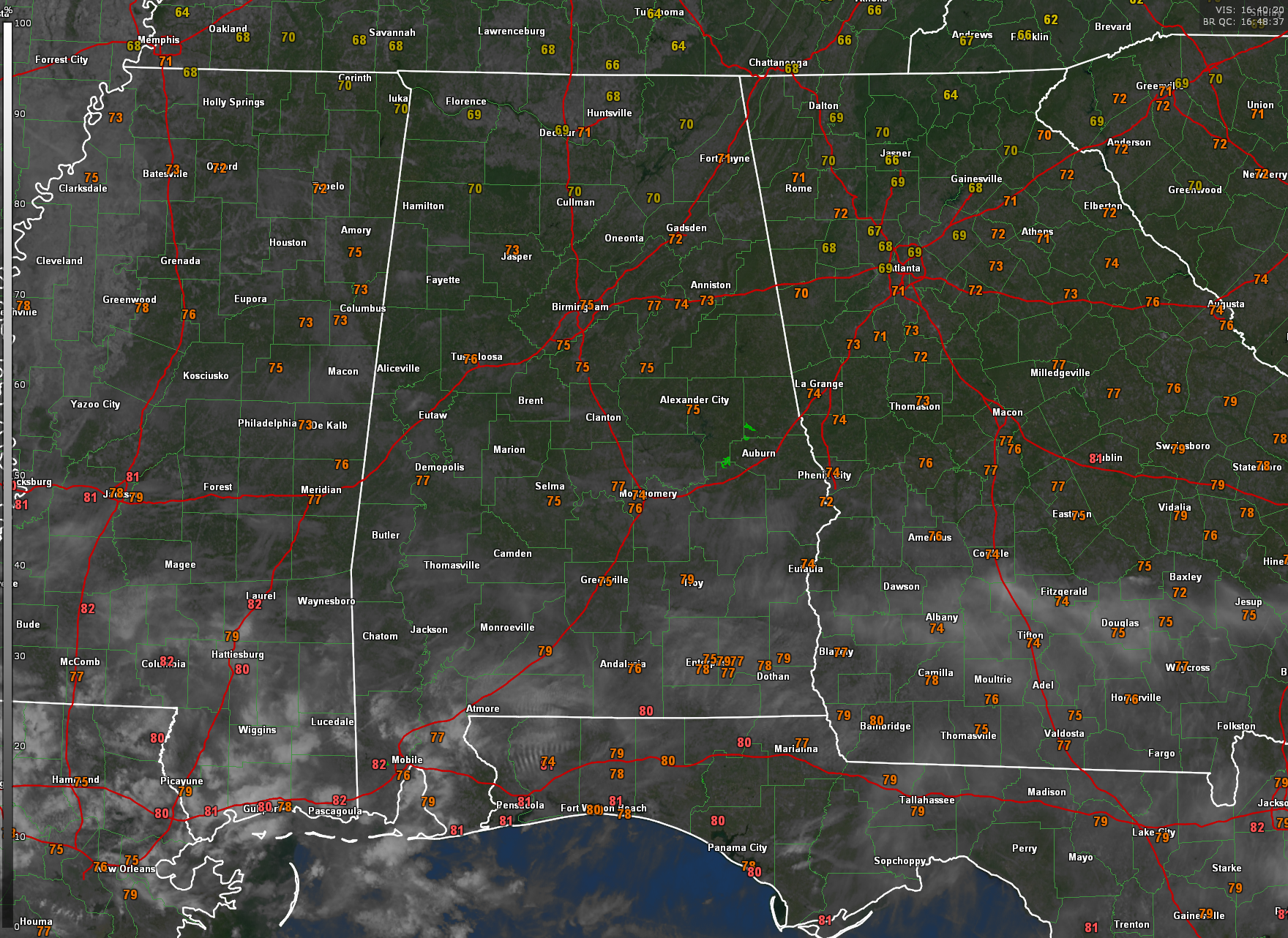
Those little green patches on the image over by Auburn are not really rain. That is just some fairly strong anomalous propagation (otherwise know as ground clutter) from a strong inversion this morning.
The average high temperature at Birmingham for October 22nd is 74F. We will be about 5-6 degrees warmer than that today, which is about 3-4 degrees warmer than I thought it would be. This morning’s 54F was about three degrees warmer than the normal for the 22nd, which is 51F.
Other Central Alabama lows this morning included 54F at Tuscaloosa, and 50F at Anniston. All of the first order reporting stations managed to stay out of the 40s across Central Alabama. That was not the case across North Alabama, where several stations got into the 40s, including Cullman which took the honors for coolest with 40F at the Ag Station. The high clouds helped keep the central part of the state warmer.
A cold front is slicing through Alabama at this hour. The front is lying along the US-80 Corridor between Demopolis and Montgomery. About the only thing you will notice behind the front are some light northerly winds.
Temperatures at this hour are in the 70s everywhere except Huntsville, Decatur, and Florence. Birmingham is at 75F, Tuscaloosa 76F, and Anniston 73F.
Lows tonight will be in the 40s and 50s again with some of that high cloudiness acting like a blanket in spots.
Monday is looking like another great day with highs in the 80 degree vicinity. I have flipped the temperature moniker for today and tomorrow to warm. Things should be a little cooler Tuesday and Wednesday, but there will be readings near 80F again by Thursday, Friday and into the weekend.
The models keep us dry until the end of the month, which is not good news for the drought or the fire danger. Fortunately no red flag warnings across the state today as wind velocities are lower and relative humidity values are slightly higher. There were a couple of wildfires on Saturday, and no one wants to deal with that.
Timing that front has trended later in the last few runs, pushing it back from Halloween onto November 1. I am sure the little ghosts and goblins will appreciate that. Parents on the other hand, are split on the matter.
In the tropics, Tammy made landfall on Barbuda last night and 90 mph winds were experienced on the island. On nearly Antigua, which was on the western side of the storm, winds did mot gust to tropical storm force. In the eastern Pacific, Norma is back over the Gulf of California as a tropical storm still, and it will reach the Mexican coast late tonight as a tropical storm, but weaken quickly thereafter. Tropical depression 18-E has formed in the eastern Pacific about 500 miles SSE of Acapulco. It is not expected to become a hurricane or affect land.
Category: Alabama's Weather, ALL POSTS, Tropical
About the Author (Author Profile)
Bill Murray is the President of The Weather Factory. He is the site's official weather historian and a weekend forecaster. He also anchors the site's severe weather coverage. Bill Murray is the proud holder of National Weather Association Digital Seal #0001 @wxhistorianSubscribe
If you enjoyed this article, subscribe to receive more just like it.


