A Warm Weekend; Much Cooler Air Begins Moving In on Monday
THIS WEEKEND
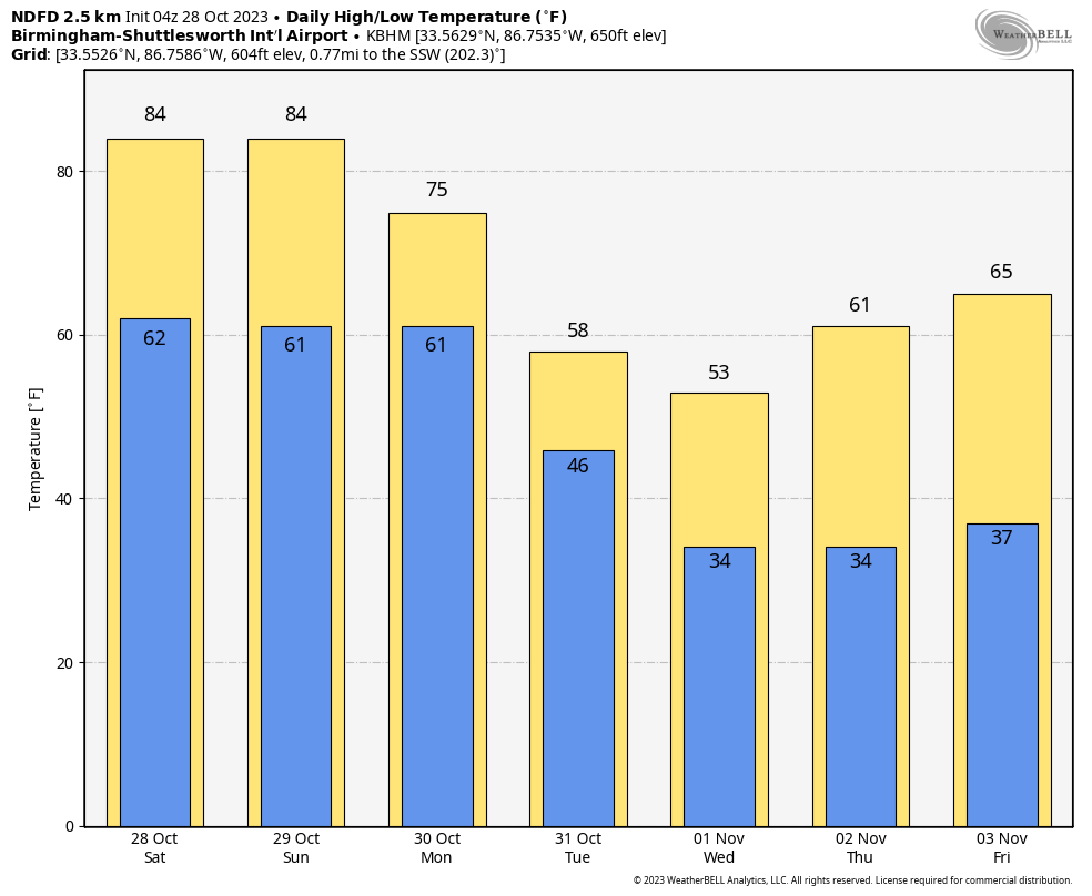
High pressure will be a dominant factor across the southeast this weekend as rain and cooler air will be held at bay. We’ll have partly to mostly sunny across Central Alabama today, with unseasonably warm temperatures. Highs in the lower to mid 80s. Sunday will be very similar, but we may have a little more sunshine than what we’ll see today. Highs once again in the lower to mid 80s.
THE WORK WEEK AHEAD
The high will lose its hold on our weather pattern and a cold front will begin working into the area on Monday that will bring much cooler temperatures, an increase in clouds and winds, and a very small chance of a few showers during the evening and overnight hours. Highs will top out in the upper 50s to the lower 80s from northwest to southeast.
The front will continue to push through the southeastern half of the area on Halloween, continuing the mostly cloudy and breezy conditions, along with the small chance of a few stray showers. I do believe at this point that trick-or-treat time will be rain-free with clearing skies. Highs only in the mid 50s to the upper 60s from northwest to southeast.
Ridging begins to rebuild over the southeast on Wednesday, but we’ll remain cool and breezy with plenty of sunshine. Highs in the 50s. Temperatures will begin to moderate as we’ll begin to see a shift in our winds out of the east. We’ll have mostly sunny skies with highs in the upper 50s to the mid 60s.
At the end of the forecast period on Friday, we’ll be a little warmer with mostly sunny skies. Highs in the mid to upper 60s.
THE TROPICS
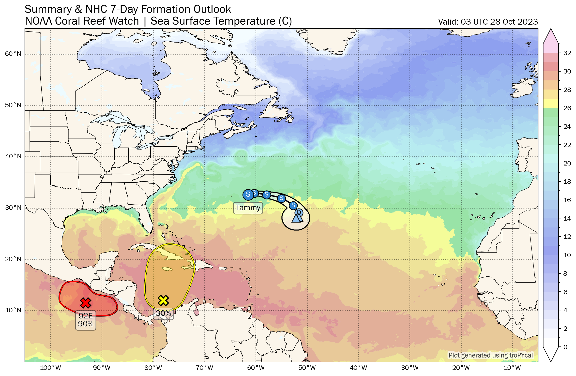
Tropical Storm Tammy continues to hang around just off to the east of Bermuda, and will continue its eastward to southeastward motion through the weekend while becoming weaker. She will become a post-tropical remnant low by Monday night. We also have a disturbance over the southwestern Caribbean Sea that has a low chance for development over the next seven days as it slowly moves northward toward Cuba, Jamaica, Haiti, and the Dominican Republic. The rest of the tropics are quiet.
ON THIS DAY IN WEATHER HISTORY
1971 – A severe early season blizzard raged across the Plateau Region and Rocky Mountain Region. Heavy snow blocked railroads and interstate highways, and record cold accompanied the storm. Lander WY received 27 inches of snow, and the temperature at Big Piney WY plunged to 15 degrees below zero.
Category: Alabama's Weather, ALL POSTS, Tropical, Weather Xtreme Videos
About the Author (Author Profile)
Scott Martin is an operational meteorologist, professional graphic artist, musician, husband, and father. Not only is Scott a member of the National Weather Association, but he is also the Central Alabama Chapter of the NWA president. Scott is also the co-founder of Racecast Weather, which provides forecasts for many racing series across the USA. He also supplies forecasts for the BassMaster Elite Series events including the BassMaster Classic.Subscribe
If you enjoyed this article, subscribe to receive more just like it.


