Saturday Briefing — Cool & Wet at Times Today
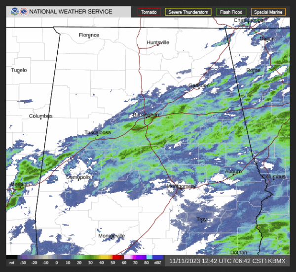
At 6:42 am, we have some showers moving across portions of Central Alabama, but as your Saturday progresses, the activity will begin to dwindle somewhat. There will be a few spots getting some light rain this afternoon and into the evening hours. Highs will only be in the mid 50s to the mid 60s across the area.
Sunday will be another mostly cloudy day as showers will continue to be possible across all of Central Alabama, but the activity will end during the afternoon from west to east. Highs will be in the upper 50s to the mid 60s.
Not a good chance to see much sunlight for the work week ahead. Monday will be a dry and mostly cloudy day, but rain chances will move in after midnight. Highs in the upper 60s to the lower 70s.
On Tuesday, a low will be moving to the northeast from the Gulf of Mexico and will cross the southern portions of the state. Rain will become likely by the afternoon hours, but the air should be stable, and no thunder is expected. Highs in the upper 50s to the lower 60s.
We’ll continue to deal with showers moving across the area on Wednesday as that low will be a very slow mover. Rain will be likely and skies will be cloudy. Highs in the mid 50s to the lower 60s.
Thursday will be another cloudy day with a chance of a few scattered showers, mainly over the eastern half of Central Alabama during the morning hours. Highs in the 60s.
And at the end of the forecast period on Friday, it will be warmer and skies will be partly to mostly cloudy. Almost everyone will stay dry, but I can’t rule out a stray shower or two. Highs in the mid 60s to the lower 70s.
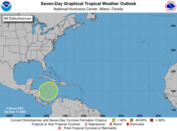
The tropics are quiet for now, but a little mischief may form over the southwestern part of the Caribbean Sea during the middle of the work week. There will be very little movement and is given a very low chance of forming into a depression.
Category: Alabama's Weather, ALL POSTS, Tropical, Weather Xtreme Videos


