Midday Nowcast: Terrific Tuesday Across Alabama
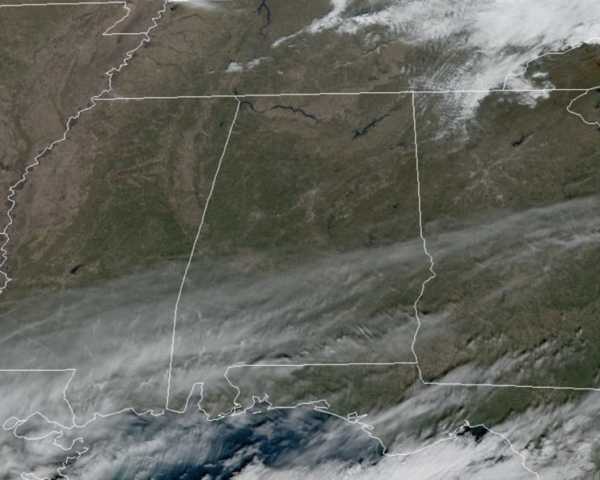
Looking great across the state today with sunshine in full supply and a cobalt blue sky. It is cooler today, but still very nice for early December with highs this afternoon in the upper 50s and lower 60s. Tonight will be mainly clear and cold with lows in the mid 30s.
USA BREIF: A clipper type system will track across the Ohio Valley, central Appalachians and mid-Atlantic regions today. Rain and some accumulating snow across the higher elevations of the central Appalachians can be expected. The Pacific Northwest and northern Rockies continue with heavy precipitation and flooding coinciding with strong winds that will make traveling difficult.
REST OF WEEK: Colder air drops into the state tomorrow, and by early Thursday morning temperatures will be below freezing over the northern half of the state. Highs tomorrow will be in the lower 50s, followed by mid and upper 50s Thursday, then rising into the 60s Friday.
CHAMPIONSHIP FOOTBALL: The Alabama Super 7 high school football championships will be played Wednesday through Friday in Tuscaloosa at Bryant-Denny Stadium. The weather will be cool and dry for all the games; daytime temperatures will be in the 50s Wednesday and Thursday, and in the 60s Friday. For the evening games, temperatures will be mostly in the 40s. No risk of any rain.
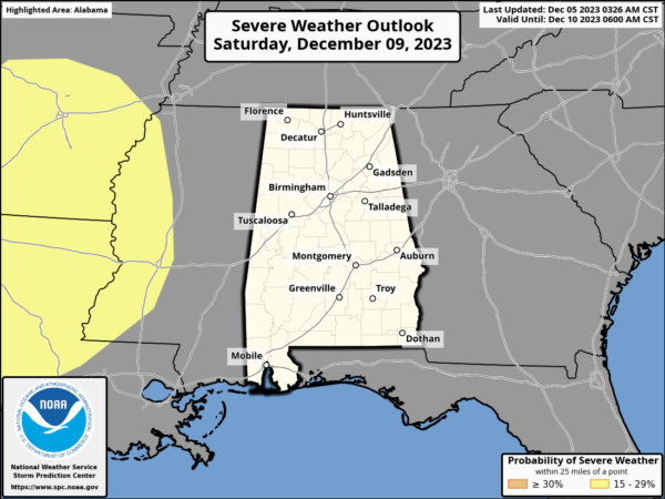
WEEKEND RAN AND STORMS: A dynamic weather system will bring rain and thunderstorms back to Alabama. Little change in the forecast for now as the best chance of rain will come late Saturday night into Sunday morning. The SPC maintains a risk of severe thunderstorms west of Alabama Saturday, but no formal risk has been defined here at this time. For now it looks like the storms will come through at a time when there is little to no surface based instability across the state, but we will watch model trends closely over the next few days.
More beneficial rain is expected over the weekend with amounts in the 1/2 to 1 inch range, with the heavier totals over the northern counties. Highs Saturday will be in the upper 60s, but behind the front, highs Sunday would fall into the 50s with a cool north breeze.
INTO NEXT WEEK: Below average temperatures highlight the forecast for much of next week as a cooler and dry air mass settles into the state. Highs will be in the 50s, while lows will be in the 30s. Most of next week looks day as well.
BEACH FORECAST CENTER: Get the latest weather and rip current forecasts for the beaches from Fort Morgan to Panama City on our Beach Forecast Center page. There, you can select the forecast of the region that you are interested in visiting.
WORLD TEMPERATURE EXTREMES: Over the last 24 hours, the highest observation outside the U.S. was 113.4F at Telfer, Australia. The lowest observation was -73.7F Iema, Russia.
CONTIGUOUS TEMPERATURE EXTREMES: Over the last 24 hours, the highest observation was 88F at De Soto City, FL. The lowest observation was 3F at Trout Lake, MI.
Category: Alabama's Weather, ALL POSTS
About the Author (Author Profile)
Macon, Georgia Television Chief Meteorologist, Birmingham native, and long time Contributor on AlabamaWX. Stormchaser. I did not choose Weather, it chose Me. College Football Fanatic. @Ryan_StinnetSubscribe
If you enjoyed this article, subscribe to receive more just like it.


