

Sunday Briefing — Showers Ending Leading to a Dry Work Week
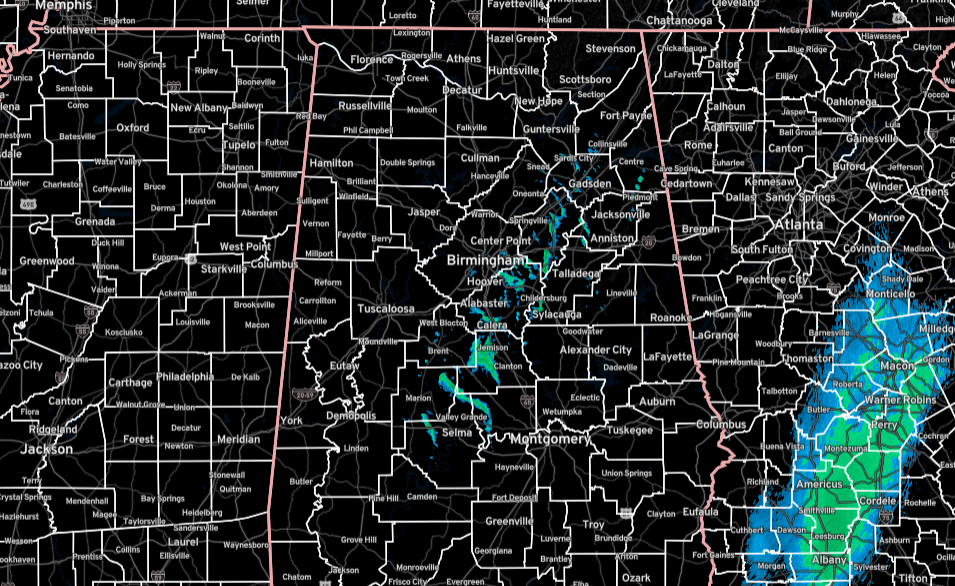
As of 5:53 this morning, much of Central Alabama is dry, but we do have some scattered light rain falling over the I-59 corridor from Collinsville down to Selma. These are slowly pushing their way eastward.
The big surface low responsible for our showers will begin moving up the East Coast today which will actually allow for drier and cooler air to be pulled down into the area. Showers should be out of here by noon and skies will be clearing. Highs in the mid 50s to the lower 60s.
On Monday, the deep trough will be over the eastern portions of the country and the axis will be already past the state. Skies will be sunny and highs in the lower 50s to the lower 60s.
High pressure will settle in close by on Tuesday that will keep us sunny and dry with much cooler temperatures. Highs in the lower 40s to the lower 50s.
The high will move to our east on Wednesday, which will start to pull some warmer air up from the Gulf of Mexico. That will also start to increase our moisture levels and a few clouds will be possible. Highs in the lower to mid 50s.
Once again, high pressure stays in control over the area on Thursday, and the weather will be nice. It will be mostly sunny with highs in the mid 50s to the lower 60s.
We start to see a disturbance form off to our west on Friday, that will bring an increase of clouds through the day. A few scattered showers will be possible during the evening and overnight hours. Highs in the upper 50s to the lower 60s.
And at the end of the forecast period on Saturday, much of the activity continues to hang out to our west, but a few stray showers will be possible throughout the day. It will be partly sunny with highs in the upper 50s to the mid 60s.
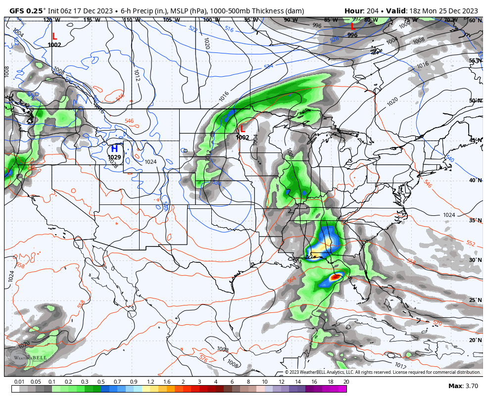
And looking out there into the Christmas holiday, Sunday will be much of the same with much of the activity staying west of Central Alabama, but showers will be possible. Unfortunately, rain will push into the area on Christmas Day and persist through much of the day. We may have to watch for some thunder during the evening as there will be a little bit of instability in place.
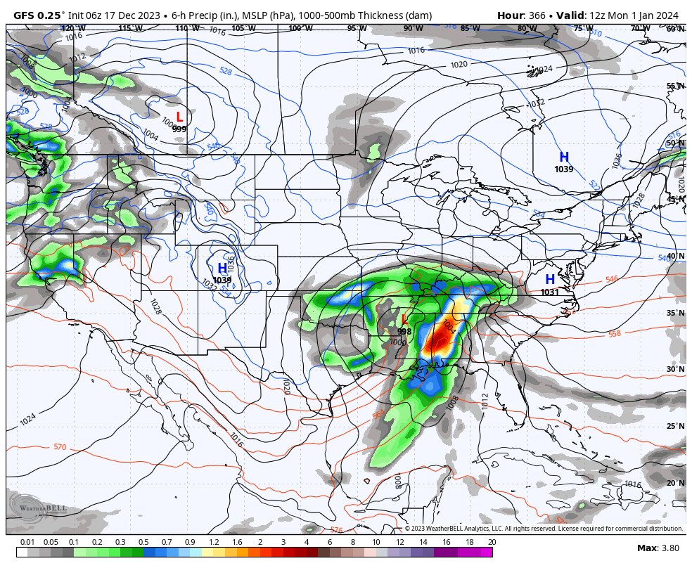
And really looking out into the future, a strong system looks to move into the area for New Year’s Eve and New Year’s Day, which looks to have the potential for some heavy rain and maybe some strong storms. We’ll continue to look at that threat as we get closer to the end of 2023.
Category: Alabama's Weather, ALL POSTS, Weather Xtreme Videos
About the Author (Author Profile)
Scott Martin is an operational meteorologist, professional graphic artist, musician, husband, and father. Not only is Scott a member of the National Weather Association, but he is also the Central Alabama Chapter of the NWA president. Scott is also the co-founder of Racecast Weather, which provides forecasts for many racing series across the USA. He also supplies forecasts for the BassMaster Elite Series events including the BassMaster Classic.Subscribe
If you enjoyed this article, subscribe to receive more just like it.


