

Afternoon Update on the Alabama Weather Situation: Forecast on Track for Light Rain/Snow Mix for Tennessee and Alabama Tonight Through Friday Night
Our upper level low is near Indianapolis this afternoon. A strong upper level disturbance is getting ready to cross the Mississippi River from Arkansas. This disturbance is triggering showers across the northern half of Arkansas and northeastern Oklahoma.
To the north of the low, rain and snow continua across the Midwest into the Great Lakes.
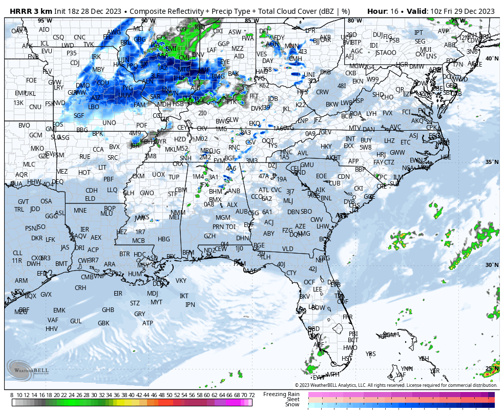
The HRRR model shows light rain showers into Northwest Alabama by 6 p.m., which was expected. Temperatures across the Tennessee Valley are currently in the middle 40s and will fall into the middle and upper 30s over Northwest Alabama and the Valley, with lower 30s Northeast.
Temperatures in the upper atmosphere will be cold enough for the precipitation to mix with or change over to snow after midnight, over the northern third of Alabama, especially over the northeastern counties like Jackson, Madison, Morgan, Marshall, Etowah, DeKalb, Cherokee, Calhoun, and Cleburne.
Here is the HRRR for 4 a.m. CST Friday morning:
The NWS in Birmingham is cautioning that a quarter inch of accumulation is possible in their northern most counties like NE Marion, Winston, Blount, northern St. Clair, Etowah, and northern Cherokee. They even have a couple of patches of 1/4 inch accumulation in northeastern Talladega, and northern Clay and Randolph counties.
Interestingly, the NWS in Huntsville is taking a dim very of any accumulations in their grids this afternoon for their counties.
Here is the 18z HRRR look at precipitation accumulation of precipitation type.
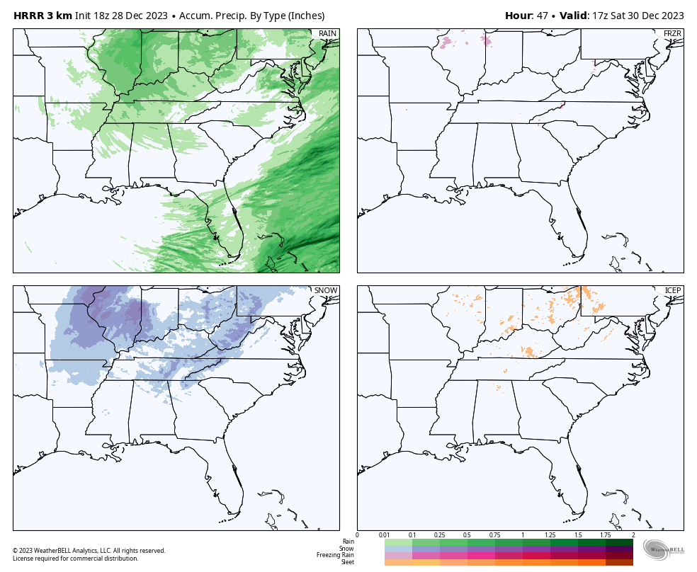
The NWS In Nashville has 1/4 to 3/4 of inch in their eastern counties with the max around eastern Putnam County, northeastern Van Buren county, and Cumberland county around Crossville. Sam Shamburger, their outstanding forecaster (who was on WeatherBrains a couple of weeks ago) did mention a “possibility” that winter weather advisories could be required overnight for the Cumberland Plateau.
The data does shou some more widespread light snow over southern Tennessee tomorrow night that could affect Madison and Jackson counties in Alabama’s Tennessee Valley. We want our Auburn fans to check the latest forecasts as road conditions if the snow materializes before they head to Nashville for the Music City Bowl.
I will be monitoring the situation carefully through the evening and overnight hours to see if anything develops.
Category: Alabama's Weather, ALL POSTS, Winter Weather
About the Author (Author Profile)
Bill Murray is the President of The Weather Factory. He is the site's official weather historian and a weekend forecaster. He also anchors the site's severe weather coverage. Bill Murray is the proud holder of National Weather Association Digital Seal #0001 @wxhistorianSubscribe
If you enjoyed this article, subscribe to receive more just like it.


