NWS Birmingham Updates Their Impacts Forecast for Thsiis Evening’s Snow
From the NWS Birmingham:
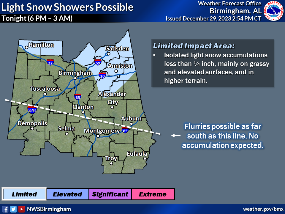
Overview: Temperatures drop into the lower to middle 30s tonight as precipitation moves in as a rain/snow mix late today toward sunset from the west. Isolated accumulations of snow are possible for northern portions of Central Alabama, but amounts should be limited to less than 1/4 inch mainly on grassy and/or elevated surfaces, especially in higher terrain. A few flurries may be noted further south, but no accumulation is expected.
Changes from previous forecast: Slight changes to the impact area and extended timing through 3 AM.
Highlights:
…WHat: Snow accumulations of less than 1/4 inch on grassy or elevated surfaces.
…Where: Northern portions of Central AL and higher terrain locations in East-Central AL.
…When: Tonight from 6 PM to 3 AM Saturday
…Impacts: Light accumulations on grassy and elevated surfaces.
Category: Alabama's Weather, ALL POSTS, Winter Weather
About the Author (Author Profile)
Bill Murray is the President of The Weather Factory. He is the site's official weather historian and a weekend forecaster. He also anchors the site's severe weather coverage. Bill Murray is the proud holder of National Weather Association Digital Seal #0001 @wxhistorianSubscribe
If you enjoyed this article, subscribe to receive more just like it.


