Radar Check at 6:35 p.m.
Rain is changing along the Alabama-Tennessee border back into southern Tennessee.
Here is a precipitation depiction by type from regional radars:
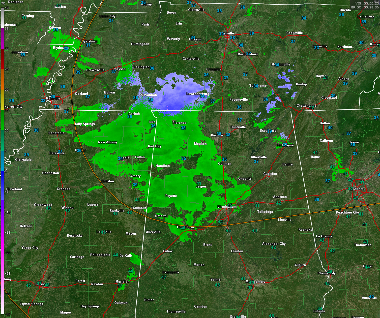
Local radar from BMX shows just how light the precipitation is. In many areas it is only sprinkles, or in some cases, even virga, which is rainfall that evaporates before reaching the ground.
Evaporative cooling is dropping temperatures 2-3 degrees, but surface readings are still well above freezing across much of North and Central Alabama. Haleyville is down to 36F. Lows by mornings will range from 28-32F.

We are not expecting travel problems, but there could be light accumulations generally north of a curvy line from Hamilton to Smoke Rise to Talladega. The accumulations will be light, less than 1/4 inch, and mainly on grassy surfaces, and elevated surfaces like decks.
Skies will will be mostly cloudy tomorrow but you can expect a few peeks of sunshine by afternoon.
Sunshine will return Sunday morning in full force and highs on New Year’s Eve will be in the middle 50s. The evening and nighttime hours will be dry until a few hours after midnight when rain will return ahead of our next storm system.
New Year’s Day looks wet. But liquid wet with no threat of wintry weather or severe weather.
Category: Alabama's Weather, ALL POSTS, Winter Weather
About the Author (Author Profile)
Bill Murray is the President of The Weather Factory. He is the site's official weather historian and a weekend forecaster. He also anchors the site's severe weather coverage. Bill Murray is the proud holder of National Weather Association Digital Seal #0001 @wxhistorianSubscribe
If you enjoyed this article, subscribe to receive more just like it.


