Watching The Radar
**No afternoon Weather Xtreme video today**
Will keep this fairly short due to ongoing weather issues…
THIS AFTERNOON: A tornado watch remains in effect the Northwest Alabama; specifically Lauderdale, Colbert, and Franklin counties. So far, development in that watch area has been limited. The moisture is fairly thin this afternoon, so storms that form will be scattered, but they certainly will have the potential to pack a punch.
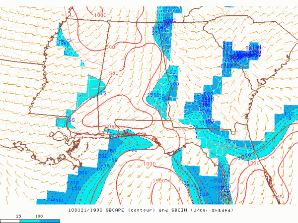
Here is a look at the instability as of 2:00…
You can see surface based CAPE values in the 500 to 1,000 j/kg category. Birmingham’s dewpoint is 58, while Montgomery has a dewpoint of 61 at 2:00; if those numbers get up into the mid 60s, that will make those CAPE values jump much higher. But, they are somewhat marginal for a big outbreak.
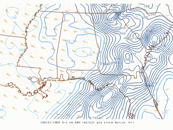
And, here is the low level helicity (0 to 1 km)…
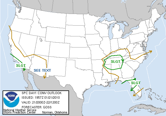
Clearly the best shear has moved off to the east, which is great news. However, we still have a brief window this afternoon for the surface winds to back around to the southeast and dewpoints to rise, which will bring greater severe weather parameters to Alabama. Here is the latest Day One Convective Outlook:
The window for severe storms will be from 3:00 to 7:00…
TOMORROW: A dry day with a partly sunny sky and a high in the low 60s. We will be in-between storm systems.
THE WEEKEND: The 12Z GFS suggests the main window for our weekend rain/storm event will be from about 12:00 midnight Saturday night through 12:00 noon Sunday. Pretty much the same thinking; mainly a heavy rain event for us, with some potential for strong storms. It seems now like the best chance of severe weather will be over the southern quarter of the state, where there will be a better degree of instability available. Rain amounts of 1 to 2 inches are likely. We will be much more specific on this system tomorrow morning.
So… now we wait and watch. You can watch the live stream from Storm Chaser 33/40 in the upper left part of the blog, along with our live radar (you can make both full screen if you choose). Ashley B is headed north in the Storm Chaser to keep an eye on things. We will post updates as the situation unfolds.
Thanks to the 3rd graders at Oak Grove Elementary today for a great time; you might recall that was the school that lost their building in the horrible EF-5 tornado April 8, 1998. Be looking for the kids on the Pepsi KIDCAM today at 5:00. We will get back to the regular “two a day” Weather Xtreme video production schedule tomorrow; the morning video will be posted by 7:00!
Category: Uncategorized


