Strong Winds Blowing Across Central North and Central Alabama But No Severe Storms At This Time
A line of storms is pushing through western Alabama at this hour, approaching the Birmingham Metro area with moderate to heavy rain and gusty winds of 55 mph.
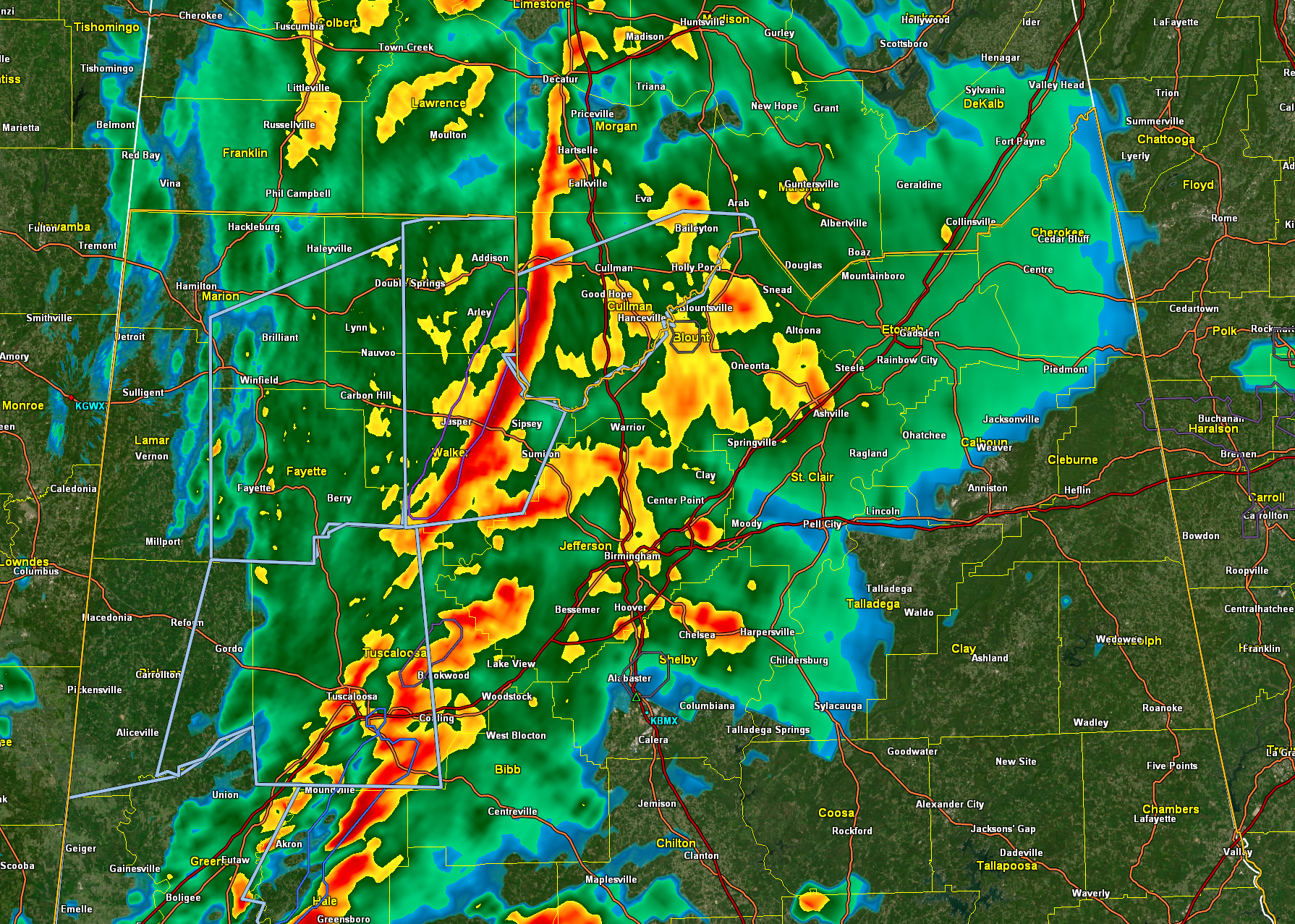
Here is the GR3 radar with significant weather advisories shown in light blue. No warnings are in effect:
Winds gusted to 41 mph at TCL as the line moved through Tuscaloosa.
Winds have gusted to 40 mph at BHM in the past hour.
Recent damage reports include a tree down involving power lines in Mulga in western Jefferson County and one 3 miles west of Sexton Bend in Tuscaloosa County.
Those were both associated with teh gradient winds everyone is experiencing.
The NWS in Birmingham has been content to cover the storms with significant weather advisories, which is a step below a severe thunderstorm warning.
The Tornado Watch in Mississippi has expired and one is not expected for Alabama at this time.
The moderate rain is moving into the Greater Birmingham area now and the heavier rain is about 30 minutes away. So far .30 inches of rain at Tuscaloosa, and rainfall amounts aren’t going to be excessive.
Category: Alabama's Weather, ALL POSTS, Severe Weather
About the Author (Author Profile)
Bill Murray is the President of The Weather Factory. He is the site's official weather historian and a weekend forecaster. He also anchors the site's severe weather coverage. Bill Murray is the proud holder of National Weather Association Digital Seal #0001 @wxhistorianSubscribe
If you enjoyed this article, subscribe to receive more just like it.


