Mid-Evening Look at What’s Happening With Our Weather
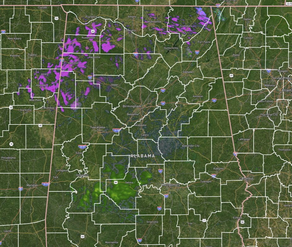
Sleet and a little bit of snow continue to fall over North Alabama and into the northwestern parts of Central Alabama (mainly Marion, Lamar, Fayette, Winston, and Walker counties). Some light showers have formed and are moving over the southern parts of the area along and near US-80 west of Montgomery to Marengo County. The main story is how the roadways are being affected up in those parts of North and Central Alabama, along with the school closings for Tuesday.
• I-65 has been shut down from mile marker 299 all the way to mile marker 318 due to ice and multiple accidents.
• US-43 has been closed due to icy conditions at AL-17.
• Plenty of slick spots and slow travel in North Alabama.
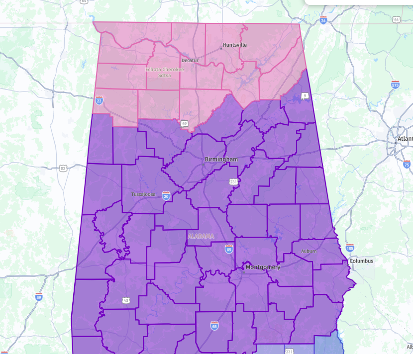
The Winter Weather Advisory for Central Alabama has been extended to now include Barbour, Bullock, Chambers, Lee, Macon, Pike, and Russell counties in the southeastern parts of the area, which will start at 3 am Tuesday morning and set to expire at 12 pm Tuesday. For the rest of the Central Alabama counties under an advisory, most of those counties will expire at 6 am or 9 am Wednesday, except for Fayette, Lamar, and Walker counties which will expire at 3 am Wednesday.
The Winter Storm Warning continues across the Tennessee Valley and including the Central Alabama counties of Marion and Winston. Those are set to expire at 6 am Tuesday morning, except for Marion and Winston counties as they are set to expire at midnight tonight.
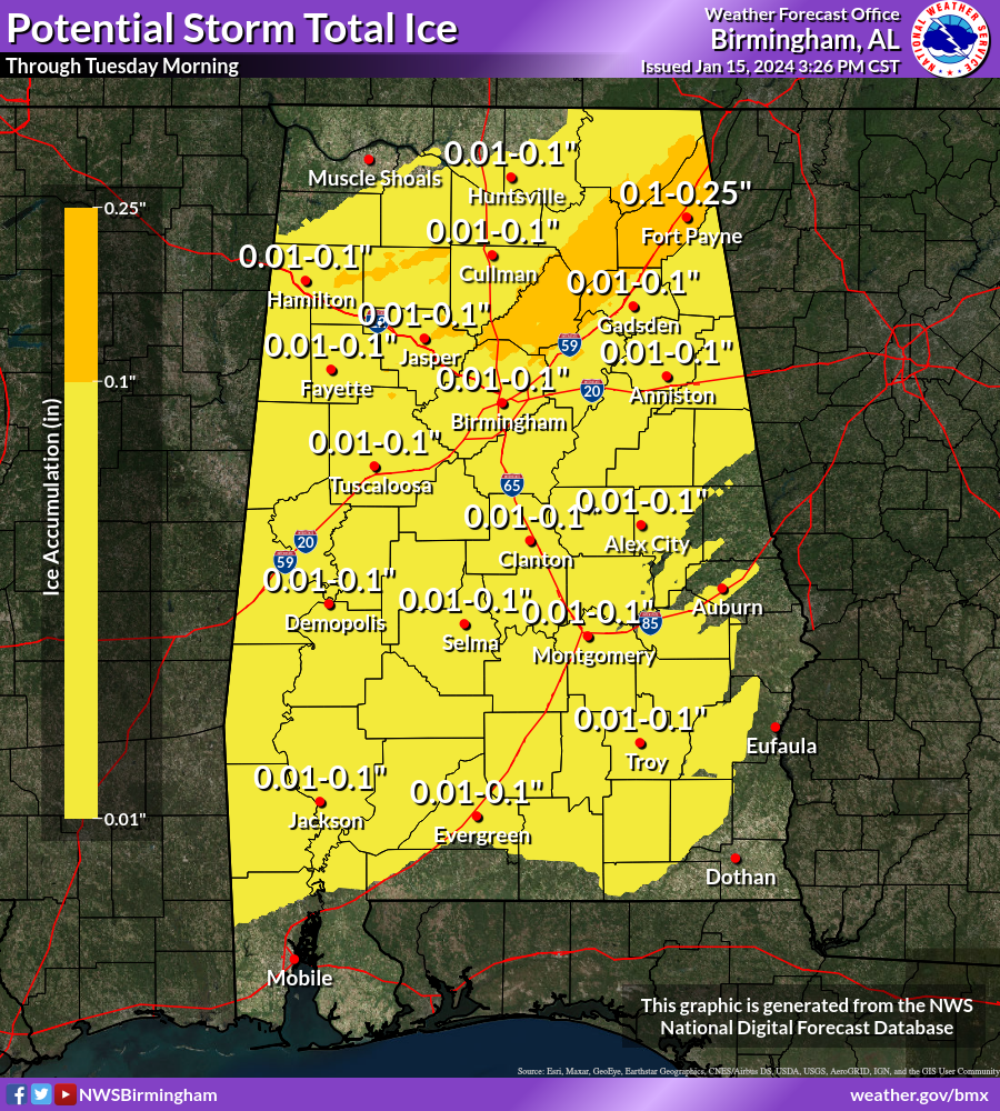
If you haven’t seen any precipitation yet, just like me, it will move in this evening. NWS Birmingham has actually increased their estimates on ice accumulation totals across parts of the area, especially for those in the northern half of the area along and north of I-59. Some have the potential to see as much as a quarter inch of ice. Even though a lot of locations are projected to get around or just above one-hundredth of an inch, that is still enough to cause traffic accidents. If you don’t have to be on the roads, then don’t do it. If you have to, be sure to take you some supplies just in case you become stranded.
Major cold will be the main story after the precipitation is over, as overnight lows tonight will reach the mid-single digits in the northwest to the upper 20s in the southeast. However, Tuesday night’s lows will be even colder as near or just below zero temperatures are expected in the northwest and only in the mid-teens in the southeast.
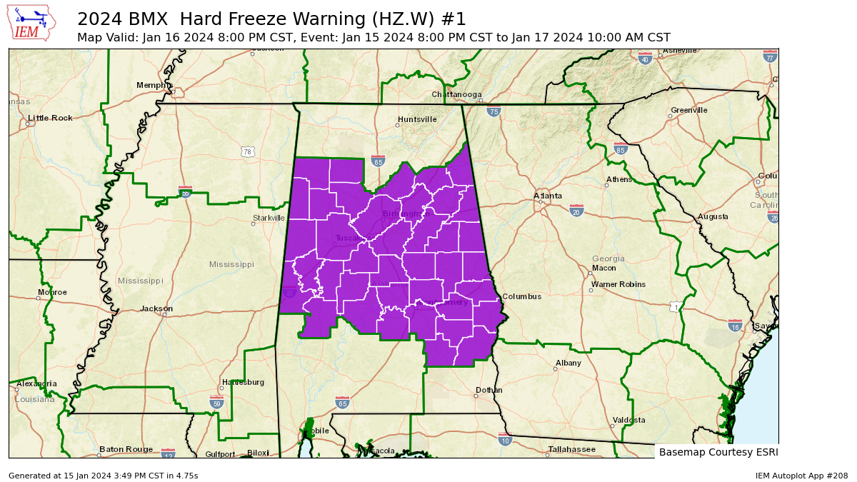
A Hard Freeze Warning has been issued for all of Central Alabama starting at 8 pm tonight and set to expire at 10 am Wednesday morning. Temperatures will drop into the teens tonight, and will remain below freezing in many locations tomorrow, and drop into the single digits and teens Tuesday night. Prolonged sub-freezing temperatures may cause pipes to burst. Bitterly cold temperatures and wind chills can result in hypothermia or frostbite. These conditions are life-threatening to those with prolonged exposure or without access to warmth. To prevent freezing and possible bursting of water pipes they should be wrapped, drained, or allowed to drip slowly. Those that have in-ground sprinkler systems should drain them and cover above-ground pipes to protect them from freezing.
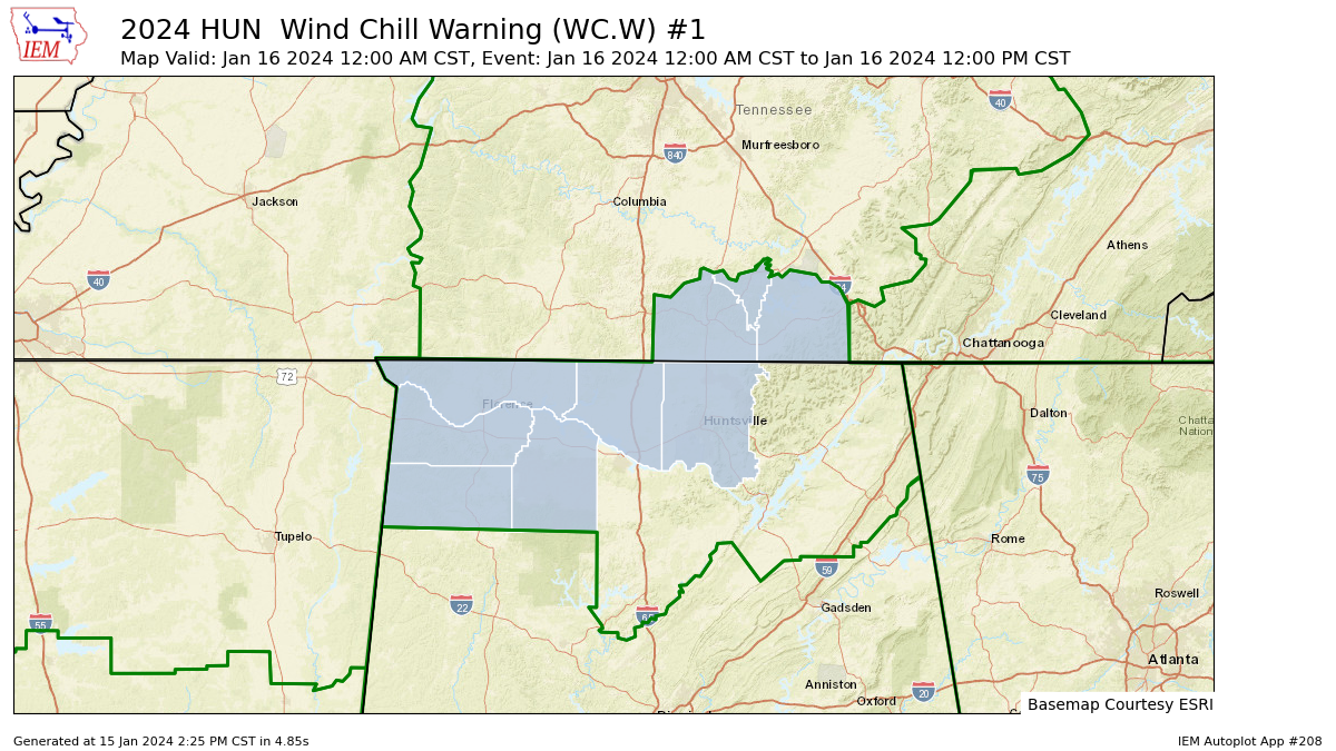
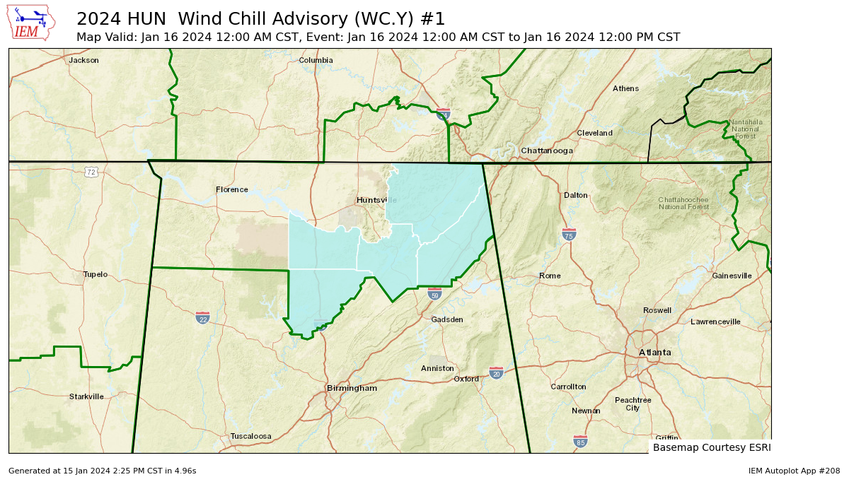
A Wind Chill Warning has been issued for Colbert, Franklin, Lauderdale, Lawrence, Limestone, and Madison counties in North Alabama starting at midnight tonight and set to expire at 12 pm Tuesday. A Wind Chill Advisory has also been issued for Cullman, DeKalb, Jackson, Marshall, and Morgan counties in North Alabama starting at midnight tonight and set to expire at 12 pm Tuesday.
Don’t let your guard down and drive unnecessarily. Once the precipitation starts in your area, it will not take long for ice to form, and you may be caught up in an accident or become stranded. Use your head tonight and stay at home.
Category: Alabama's Weather, ALL POSTS, Winter Weather
About the Author (Author Profile)
Scott Martin is an operational meteorologist, professional graphic artist, musician, husband, and father. Not only is Scott a member of the National Weather Association, but he is also the Central Alabama Chapter of the NWA president. Scott is also the co-founder of Racecast Weather, which provides forecasts for many racing series across the USA. He also supplies forecasts for the BassMaster Elite Series events including the BassMaster Classic.Subscribe
If you enjoyed this article, subscribe to receive more just like it.


