Severe Storm Threat Looking to Be a Little Less, But Don’t Let Down Your Guard
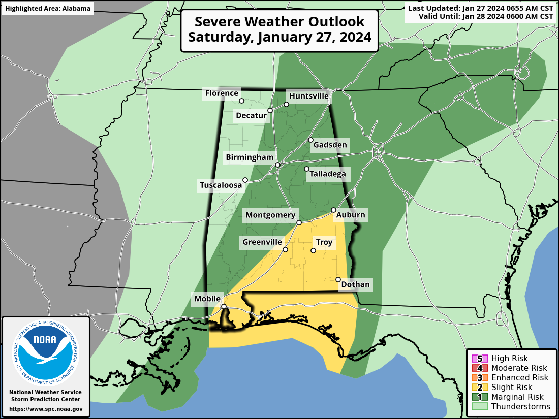
The latest update from the Storm Prediction Center is out, and they have removed much of Central Alabama from the Slight Risk, leaving the locations along and south of I-85 and along and east of I-65 in the Slight Risk. The Marginal Risk has been shifted as well, moving it eastward to now include locations along and east of a line from Decatur to Tuscaloosa to Demopolis.
We could see the potential of severe storms developing this afternoon over the parts of the area under a severe risk category as there will be cooling in the mid-levels of the atmosphere and strong shear in place, plus, we’ll have the forcing from the approaching front. The only question about this afternoon’s activity is that will the atmosphere have enough time to recover after this morning’s activity before the cold front moves through. However, models suggest that any cells that can stay together may begin to rotate, bringing a threat of a brief tornado or damaging winds.
For the locations west of the Marginal Risk, the threat of severe weather will not occur for you. From Jasper to Anniston and Demopolis to Fort Deposit, the window for the severe weather threat will be from 1pm to 5pm this afternoon. For locations east of the line from Anniston to Fort Deposit, your main window will be from 4pm to 8pm tonight.
A wake low may form on the back of this first wave of rain and produce some strong winds potentially as high as 35-40 mph through the afternoon outside of any thunderstorm activity. NWS Birmingham has mentioned the possibility of a Wind Advisory being issued if the wind becomes widespread enough.
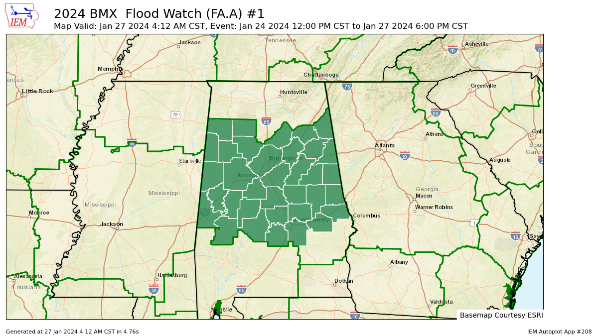
We also have a Flood Watch up for Autauga, Bibb, Blount, Calhoun, Chambers, Cherokee, Chilton, Clay, Cleburne, Coosa, Dallas, Elmore, Etowah, Fayette, Greene, Hale, Jefferson, Lamar, Lee, Lowndes, Macon, Marengo, Marion, Montgomery, Perry, Pickens, Randolph, Shelby, St. Clair, Sumter, Talladega, Tallapoosa, Tuscaloosa, Walker, Winston counties in Central Alabama until 6 pm this evening.
Bill Murray and myself will be with you on the blog through the day to bring you any updates and if/when any watches. warnings, or advisories have been issued. While the threat has lessened somewhat, do not let down your guard and stay weather aware.
Category: Alabama's Weather, ALL POSTS, Severe Weather
About the Author (Author Profile)
Scott Martin is an operational meteorologist, professional graphic artist, musician, husband, and father. Not only is Scott a member of the National Weather Association, but he is also the Central Alabama Chapter of the NWA president. Scott is also the co-founder of Racecast Weather, which provides forecasts for many racing series across the USA. He also supplies forecasts for the BassMaster Elite Series events including the BassMaster Classic.Subscribe
If you enjoyed this article, subscribe to receive more just like it.


