First Rain Batch Makes an Exit, Second Batch of Storms Arriving This Afternoon/Evening
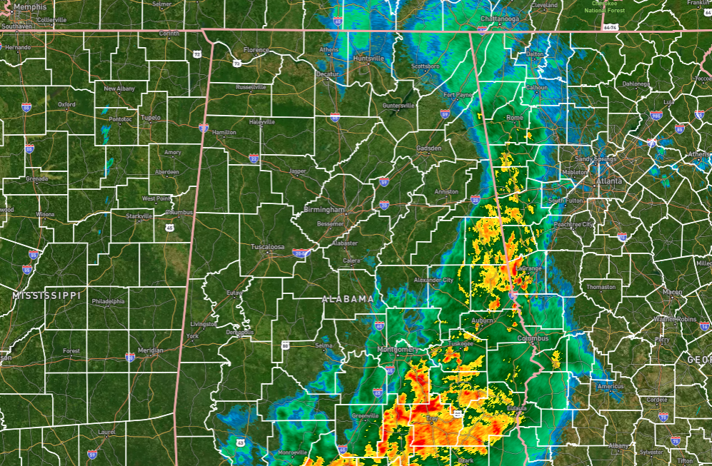
Rain has ended for much of North and Central Alabama as a wake low has developed and helped that back edge of the rain shield to move eastward a little quicker. However, rain continues for locations east of Scottsboro to Alexander City to just east of Selma. Some of that rain is moderate to heavy, especially in the southeastern parts of the area. We’re not out of the woods yet, as a second wave of rain and storms is projected to move through this afternoon and evening. Afternoon highs will reach the lower 60s to the lower 70s.
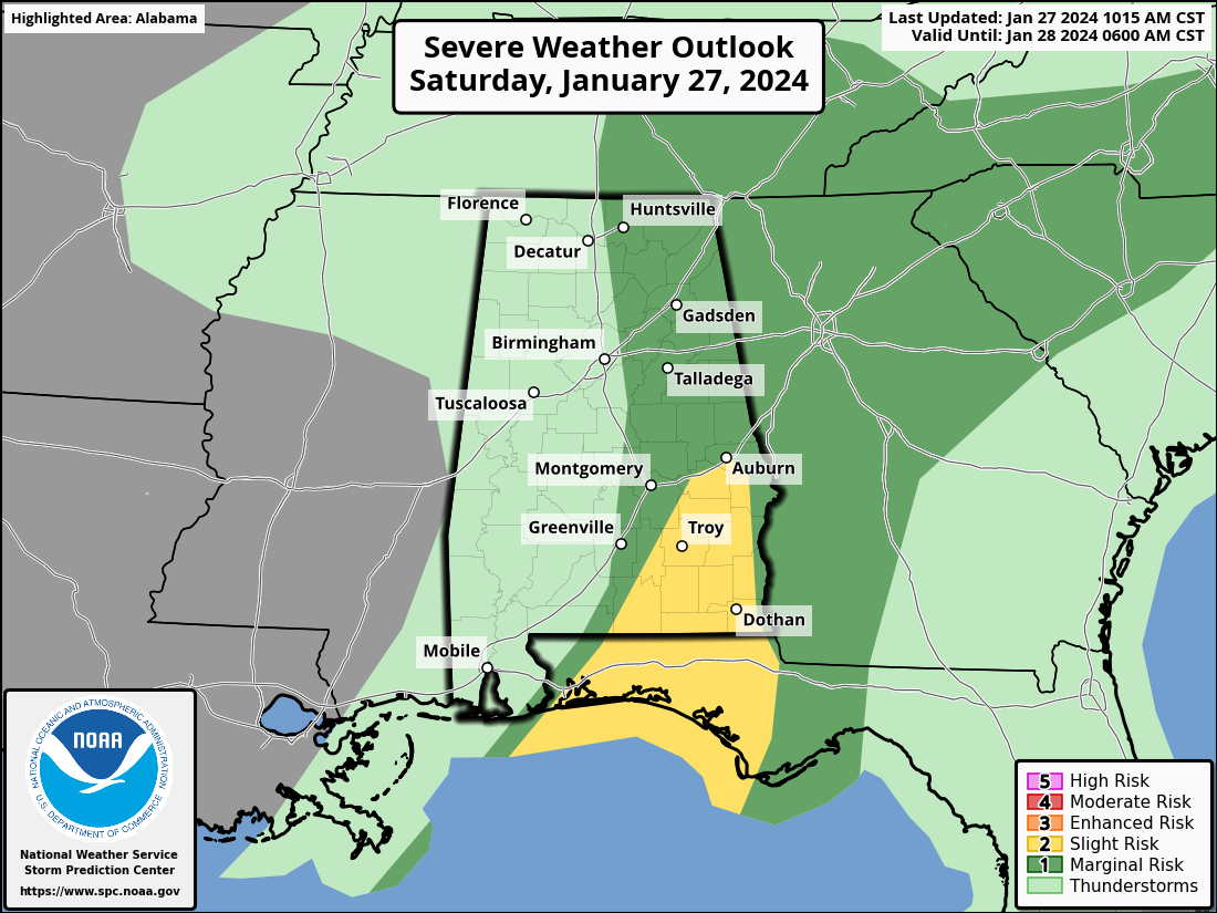
The latest update from the Storm Prediction Center has lessened the risk areas once again, now pretty much confining the risks to the eastern half of the state. A Marginal Risk is up for locations along and west of a line from Madison to Trussville to Autaugaville, while a Slight Risk is up for locations along and south of a line from Pine Level to Auburn to just west of Eufaula. We are still looking at the threat of a brief tornado along with damaging winds up to 60 mph for those risk locations from now through the afternoon and most likely coming to an end by 8pm.
We also have a Flood Watch up for Autauga, Bibb, Blount, Calhoun, Chambers, Cherokee, Chilton, Clay, Cleburne, Coosa, Dallas, Elmore, Etowah, Fayette, Greene, Hale, Jefferson, Lamar, Lee, Lowndes, Macon, Marengo, Marion, Montgomery, Perry, Pickens, Randolph, Shelby, St. Clair, Sumter, Talladega, Tallapoosa, Tuscaloosa, Walker, Winston counties in Central Alabama until 6 pm this evening.
After the frontal passage, Sunday will be a mostly cloudy day across the area, and a few light wrap-around showers will be possible north of a line from Hamilton to Bessemer to Alexander City. Afternoon highs will be much cooler and breezy with highs in the mid 40s to the lower 50s. Winds will be sustained in the 10-15 mph range with gusts up to 25-30 mph possible.
Category: Alabama's Weather, ALL POSTS, Severe Weather
About the Author (Author Profile)
Scott Martin is an operational meteorologist, professional graphic artist, musician, husband, and father. Not only is Scott a member of the National Weather Association, but he is also the Central Alabama Chapter of the NWA president. Scott is also the co-founder of Racecast Weather, which provides forecasts for many racing series across the USA. He also supplies forecasts for the BassMaster Elite Series events including the BassMaster Classic.Subscribe
If you enjoyed this article, subscribe to receive more just like it.


