Tracking Strong Storms Over Central Mississippi
We are tracking a widespread area of rain and thunderstorms that extends from Northwest and North Alabama back through the northwestern half of Alabama.
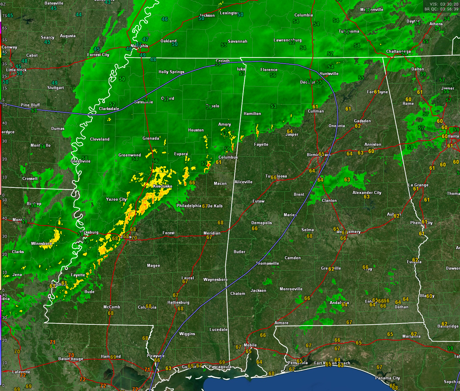
Storms over Central Mississippi back into northeastern Louisiana are intensifying tonight. Although instability is low, low level helicity is high, and there could be a couple of brief tornadoes overnight across across South Central Mississippi, as well as damaging wind gusts.
These storms will move into South Central Alabama overnight, but are not expected to be severe. Just loud with some lightning and thunder.
More storms will develop over North Central Texas that will be sliding east through the day. Those storms are rumbling through places like Mineola, Tyler, Gilmer, and Longview. They will roll through Shreveport around 11 a.m., and cross the Mississippi River around 2 p.m.
Scattered showers and storms will break out across parts of Alabama by 2-3 p.m. These storms could become severe with damaging winds and the possibility of a couple of tornadoes. The biggest threat for a tornado may be over West Central Alabama starting around 3-4 p.m. through about 8 p.m.
The main line of storms will traverse Central and North Alabama between 4-midnight, settling into a west-east orientation across the middle of the state. Additional storms will form across Mississippi and western Alabama during the overnight hours.
By early Monday morning, another line of storms will form in the I-59 Corridor ahead of a cold front. Those storms will push southeastward into the afternoon. Some of them may become severe during the day.
We will be tracking the storms overnight tonight and Sunday, into Monday.
Category: Alabama's Weather, ALL POSTS, Severe Weather
About the Author (Author Profile)
Bill Murray is the President of The Weather Factory. He is the site's official weather historian and a weekend forecaster. He also anchors the site's severe weather coverage. Bill Murray is the proud holder of National Weather Association Digital Seal #0001 @wxhistorianSubscribe
If you enjoyed this article, subscribe to receive more just like it.


