New SPC Outlook Includes Enhanced Risk Just to our West
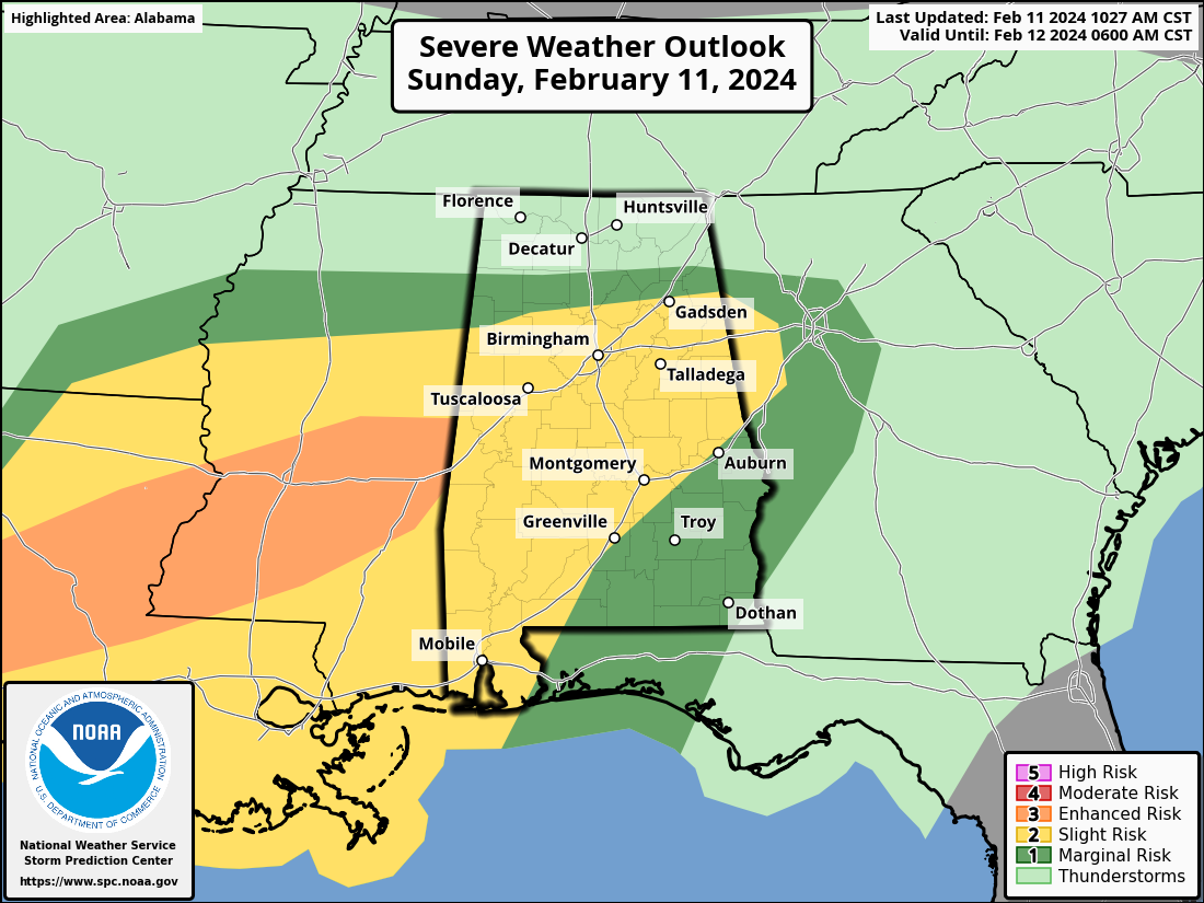
The 16z SPC Day One is out, and it has an upgraded area of enhanced risk (3/5) just to the west of Alabama in Central Mississippi back into Central Louisiana.
From the outlook, issued by Rich Thompson and Nathan Wendt:
…THERE IS AN ENHANCED RISK OF SEVERE THUNDERSTORMS THIS AFTERNOON
INTO EARLY TONIGHT FROM SOUTHEAST TX TO CENTRAL LA/MS…
…SUMMARY…
A few tornadoes, some of which could be strong, very large hail to
the size of baseballs, and isolated wind damage are all expected
through tonight from southeast Texas into central parts of Louisiana
and Mississippi. More isolated severe storms will be possible into
Alabama and western Georgia.
…Southeast TX today to central LA/MS/AL through tonight…
A midlevel shortwave trough over west TX will continue eastward over
TX/OK through tonight. Associated surface cyclogenesis is expected
today along a baroclinic zone across southeast TX, and the wave
cyclone will subsequently move east-northeastward into MS tonight.
Ongoing/elevated supercells may persist across northern LA through
midday/early afternoon along the northeast edge of the steeper
midlevel lapse rates and larger buoyancy, with large hail/damaging
winds possible. The primary severe threat should evolve from the
ongoing southeast TX supercells, and with additional storm
development near the warm front through the afternoon/evening into
LA/MS.
A moist/unstable warm sector with upper 60s dewpoints and
temperatures warming into the 70s is already established along and
south of the baroclinic zone across southeast TX into southern
LA/MS. The boundary should move a little northward today as a warm
front and provide a focus for additional severe storms through
tonight as far east as MS/AL. The steep midlevel lapse rates
(7.5-8.5 C/km) in 12z observed soundings and long hodographs will
favor isolated very large hail up to 2.5-2.75″ diameter with the
more intense supercells today from southeast TX into central LA, and
by this evening into central MS. Low-level shear/hodograph
curvature will be sufficient for tornadic supercells, with some
potential for a couple of strong tornadoes in this same corridor.
..Thompson/Wendt.. 02/11/2024
Category: Alabama's Weather, ALL POSTS, Severe Weather
About the Author (Author Profile)
Bill Murray is the President of The Weather Factory. He is the site's official weather historian and a weekend forecaster. He also anchors the site's severe weather coverage. Bill Murray is the proud holder of National Weather Association Digital Seal #0001 @wxhistorianSubscribe
If you enjoyed this article, subscribe to receive more just like it.


