The After Halftime Show Weather Update
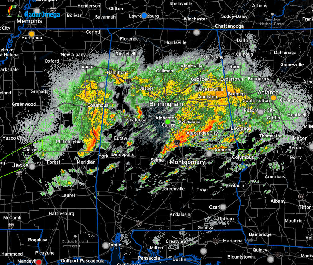
No severe weather watches or warnings are in effect for North/Central Alabama at the moment, but that doesn’t mean that we don’t have rain and storms on radar. Much of the northern half of Central Alabama and a good portion of the Tennessee Valley are getting some rain, while the southern half of the area is mostly dry, with only some spotty showers and storms.
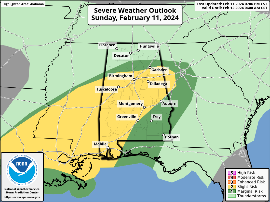
A Slight Risk for severe storms remains up for much of the area, including locations south and west of a line from Fayette to Steele to Lanette to Tuskegee. A Marginal Risk is up north of the Slight Risk to as far north as Sulligent to Arab to just north of Cedar Bluff, and south of the Slight Risk including the southeastern parts of Central Alabama.
We are in the main window for the threat of strong to severe storms until around the 1 pm hour on Monday. Tornadoes, damaging winds, and quarter-size hail remain possible with any severe storm that develops. We have a warm front slowly moving northward across Central Alabama, with much of the activity occurring north of the front. The atmosphere south of the front is conditionally favorable for the development of supercells that will be capable of all severe hazards. As a low pressure center moves closer to the area, the atmosphere will remain supportive, and the threat will continue into the morning hours on Monday.
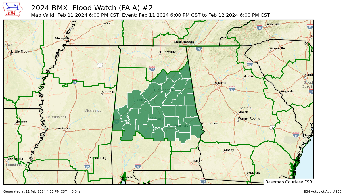
Flooding may continue as an issue through the rest of the event, and a Flash Flood Watch is up until 6 pm Monday evening for Autauga, Bullock, Dallas, Elmore, Greene, Hale, Lee, Lowndes, Macon, Marengo, Montgomery, Perry, Russell, Sumter, Bibb, Blount, Calhoun, Chambers, Cherokee, Chilton, Clay, Cleburne, Coosa, Etowah, Jefferson, Randolph, Shelby, St. Clair, Talladega, Tallapoosa, and Tuscaloosa counties in Central Alabama.
Enjoy the rest of the game while it is quiet, but keep those warning devices handy. For now, a few warnings are still possible, as we are not out of the woods yet.
Category: Alabama's Weather, ALL POSTS, Severe Weather
About the Author (Author Profile)
Scott Martin is an operational meteorologist, professional graphic artist, musician, husband, and father. Not only is Scott a member of the National Weather Association, but he is also the Central Alabama Chapter of the NWA president. Scott is also the co-founder of Racecast Weather, which provides forecasts for many racing series across the USA. He also supplies forecasts for the BassMaster Elite Series events including the BassMaster Classic.Subscribe
If you enjoyed this article, subscribe to receive more just like it.


