Midday Nowcast: Severe Clear
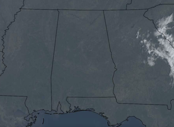
It is a gorgeous day across Alabama with sunshine and blue sky in full supply. We are warming up nicely today as well, after the sub-freezing start to the day, many locations are seeing highs in the 50s and 60s this afternoon. Tonight will be another cold and frosty night with a clear sky, lows will fall into the upper 20s and lower 30s.
USA BRIEF: Heavy rain may cause flooding along the Central California coast and the Transverse Range in Southern California. Severe thunderstorms pose a threat for hail, damaging wind gusts, and an isolated tornado across portions of the Sacramento Valley. A few feet of snow may fall over the Sierra Nevada and Shasta Siskiyous. A warming trend is expected across the Great Plains and Mississippi Valley.
WARMING TREND: Each day this week will be warmer than the previous one with widespread 60s tomorrow, and low 70s possible Wednesday and Thursday. These days will feature plenty of sunshine, and it will give us a nice taste of spring-like weather across Alabama. Late Thursday, a cold front will bring some rain to the northern 2/3 of the state, but with limited moisture, rain amounts will be under 1/2 inch. No risk of severe storms, and probably very little thunder.
FRIDAY AND THE WEEKEND: Finally a decent weekend of weather for Alabama with no rain or cloudy and cold temps as dry air settles into the state. We are forecasting mostly sunny, pleasant days and fair nights Friday through the weekend. Highs will be mostly in the 60s Friday and Saturday, followed by low 70s Sunday.
NEXT WEEK: It looks like the warmest week so far this year with highs mostly in the 70s through Wednesday. A feature will bring some rain to the state Tuesday and Tuesday night, otherwise the rest of the week looks mostly dry. Highs back down a bit into the 60s Thursday and Friday. Still no sign of any high impact weather event (ice, snow, severe cold, heavy rain, severe storms, tornadoes) for the Deep South for the next ten days. Enjoy this calmer weather pattern while you can, we know we will get busy sooner than later in the coming weeks as we begin the transition to spring.
BEACH FORECAST CENTER: Get the latest weather and rip current forecasts for the beaches from Fort Morgan to Panama City on our Beach Forecast Center page. There, you can select the forecast of the region that you are interested in visiting.
WORLD TEMPERATURE EXTREMES: Over the last 24 hours, the highest observation outside the U.S. was 118.8F at Mardie, Australia. The lowest observation was -69.3F at Concordia, Antarctica.
CONTIGUOUS TEMPERATURE EXTREMES: Over the last 24 hours, the highest observation was 80F at El Centro, CA. The lowest observation was -10F at Forest Center, MN.
Category: Alabama's Weather, ALL POSTS
About the Author (Author Profile)
Macon, Georgia Television Chief Meteorologist, Birmingham native, and long time Contributor on AlabamaWX. Stormchaser. I did not choose Weather, it chose Me. College Football Fanatic. @Ryan_StinnetSubscribe
If you enjoyed this article, subscribe to receive more just like it.


