Alabama Weather Update at 945 a.m.
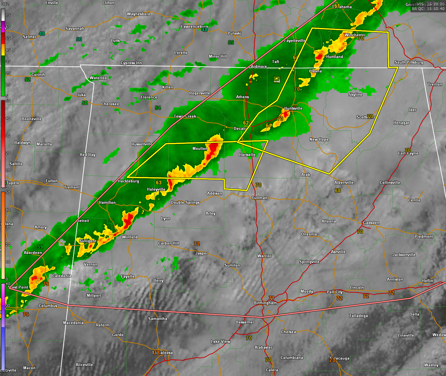
Severe thunderstorm warnings continue ahead of a line of strong thunderstorms over North Alabama.
Currently, warnings are in effect for parts of Jackson, Marshall, Madison, Morgan, Lawrence, northwestern Cullman, and Franklin Counties.
The strongest storms at this hour are along I-565 in Madison County, approaching the Huntsville area, and across Lawrence County, approaching Moulton, extending back into northern Winston County; strong indications of damaging winds with the Lawrence County storm.
Further south, strong but below severe limits, are storms over southern Marion back into Lamar Counties from west of Brilliant to east of Twin, Guin, and Sulligent. More strong storms over Monroe and Clay counties are about to move into Lowndes County in Mississippi. These storms will Lamar into northern Pickens counties over the next hour.
No severe weather watches are in effect for Alabama at this hour, and none are expected, but the stronger storms will produce damaging wind gusts to 60 mph or higher, hail, lots of lightning, and heavy rain.
Category: Alabama's Weather, ALL POSTS, Severe Weather
About the Author (Author Profile)
Bill Murray is the President of The Weather Factory. He is the site's official weather historian and a weekend forecaster. He also anchors the site's severe weather coverage. Bill Murray is the proud holder of National Weather Association Digital Seal #0001 @wxhistorianSubscribe
If you enjoyed this article, subscribe to receive more just like it.


