Midday Nowcast: Cool Monday; Warming Trend Ahead
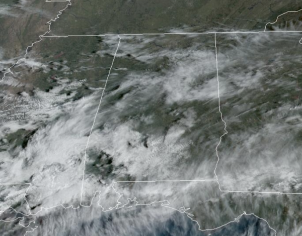
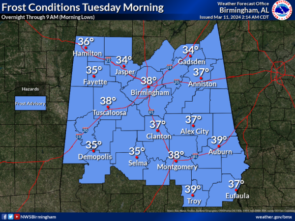
We are seeing some sun and some clouds today, but overall it is a nice late winter’s day across Alabama. After the cold start, we are seeing temperatures this afternoon climb into the low and mid 60s. Tonight will be clear and cold, and once again some of the colder spots could drop to the freezing mark early tomorrow morning. All of Central Alabama is included in a Frost Advisory overnight.
USA BRIEF: Dry, gusty winds will create critical fire weather over the southern High Plains into the central Plains, and Guam today, then lingering over the southern High Plains through Wednesday. Another storm system will move over the Northwest U.S. today into the middle of this week bringing gusty winds, low elevation rain and heavy mountain snow to the region.
WARMING TREND: Warmer days are ahead for Alabama with upper 60s and low 70s tomorrow, but by the end of the week we will see high in the upper 70s and lower 80s. Rain returns Thursday night, and we have rain and thunderstorms in the forecast for Friday statewide. A few strong storms are possible Friday, and at this time, it looks like hail will be the main threat with stronger thunderstorms.
WET WEEKEND WEATHER: The weather will remain unsettled as we roll into the weekend. We will maintain the chance of rain on both days. Rain amounts Friday through Sunday will be in the 1-4 inch range for most locations across North/Central Alabama.
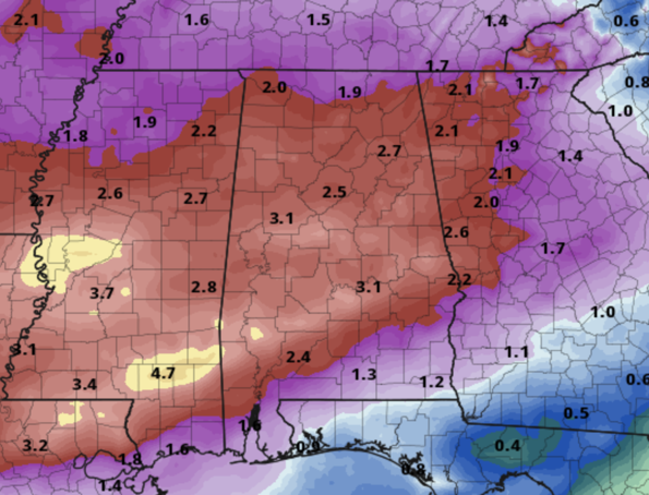
March is typically Central Alabama’s wettest month of the year, so heavy rain events are not unusual this time of year. It will remain mild with highs in the lower 70s both Saturday and Sunday. In won’t rain all weekend as there will be dry periods, but bottom line is to plan on a wet weekend.
BEACH FORECAST CENTER: Get the latest weather and rip current forecasts for the beaches from Fort Morgan to Panama City on our Beach Forecast Center page. There, you can select the forecast of the region that you are interested in visiting.
WORLD TEMPERATURE EXTREMES: Over the last 24 hours, the highest observation outside the U.S. was 115.0F at Vioolsdrif, South Africa. The lowest observation was -81.6F at Vostok, Antarctica.
CONTIGUOUS TEMPERATURE EXTREMES: Over the last 24 hours, the highest observation was 89F at Hollywood, FL. The lowest observation was -4F at Grand Lake, CO.
Category: Alabama's Weather, ALL POSTS
About the Author (Author Profile)
Macon, Georgia Television Chief Meteorologist, Birmingham native, and long time Contributor on AlabamaWX. Stormchaser. I did not choose Weather, it chose Me. College Football Fanatic. @Ryan_StinnetSubscribe
If you enjoyed this article, subscribe to receive more just like it.


