Midday Nowcast: Sun, Clouds, and Warm Temperatures
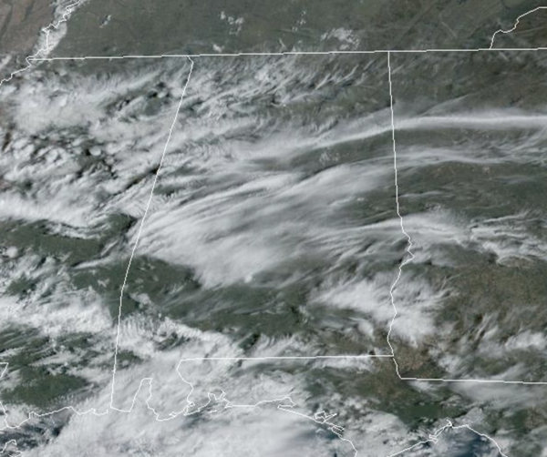
WONDERFUL WEDNESDAY: The warming trend continues today and tomorrow with more sun than clouds we are seeing highs in the mid to upper 70s this afternoon, followed by upper 70s and lower 80s tomorrow. Clouds will begin to increase late tomorrow, with some showers returning to Alabama tomorrow night.
USA BRIEF: A winter storm developing across the central Rockies today will spread heavy snow across the area, including the Denver Metro, through Friday, with heavy snow expanding into the southern Rockies beginning Thursday. Additionally, extremely critical fire weather is forecast over the southern Plains and severe thunderstorms are forecast over a part of the central Plains today.
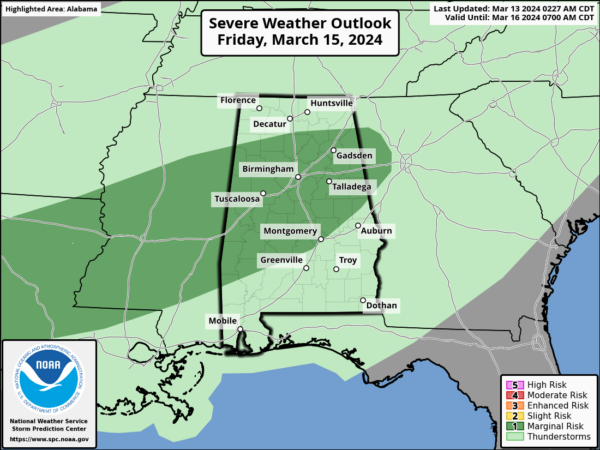
FRIDAY: Rain and thunderstorms are in the forecast for statewide Friday. A few strong storms are possible Friday, and the SPC has introduced a low end “marginal risk” (level 1/5) of severe thunderstorms for parts of North/Central Alabama Friday.
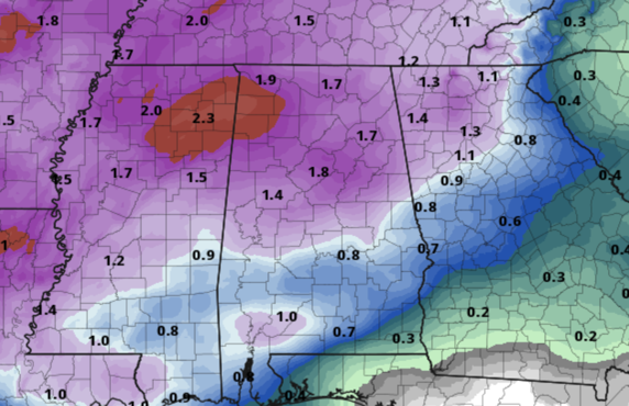
Stronger storms Friday will be capable of producing hail and strong, gusty winds. Tornadoes are not expected based on the forecast wind profiles. Rain amounts on Friday will be in the 1-2 inch range for most of the state and we could see some areas of isolated flooding develop.
WEEKEND WEATHER: The forecast for Saturday is trending drier and for now, most of the day looks rain free with just a few isolated showers, mostly over the southern counties. More widespread rain is likely Sunday, with the highest coverage over the southern 2/3 of Alabama as a low tracks along the Gulf Coast. The high Saturday will be in the low to mid 70s, followed a highs in the upper 60s and lower 70s Sunday.
ANOTHER COLD SNAP: Colder air moves into Alabama Monday, and the weather for the first half of the week will be noticeably colder. Highs Monday and Tuesday will be in the 50s, well-below average for the first day of Spring which is Tuesday. Tuesday morning lows will be in the upper 20s and lower 30s across the North/Central Alabama with another freeze warning likely. Again, it remains too earl to be planting anything. Temperatures begin to moderate through the week and rain will likely return by either Thursday or Friday.
BEACH FORECAST CENTER: Get the latest weather and rip current forecasts for the beaches from Fort Morgan to Panama City on our Beach Forecast Center page. There, you can select the forecast of the region that you are interested in visiting.
WORLD TEMPERATURE EXTREMES: Over the last 24 hours, the highest observation outside the U.S. was 113.0F at Garoua, Cameroon. The lowest observation was -82.3F at Vostok, Antarctica.
CONTIGUOUS TEMPERATURE EXTREMES: Over the last 24 hours, the highest observation was 92F at Rio Grande Village, TX. The lowest observation was -4F at Mackay, ID.
Category: Alabama's Weather, ALL POSTS


