Midday Nowcast: 80s Today, Rain Tomorrow
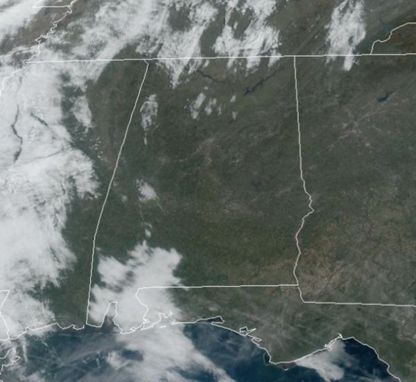
VERY WARM: Today is likely the warmest day so far this year for many locations across Alabama as low 80s will be widespread through the afternoon hours. Clouds will begin to increase late today, with some showers returning to Alabama overnight.
USA BRIEF: A winter storm will spread heavy snow tonight across the Central Rockies, including the Denver Metro, through Friday. Scattered severe thunderstorms are expected to peak in intensity this evening and persist on an isolated basis overnight, from parts of northern/central Kansas east towards the Lower Missouri Valley.
WET & STORMY FRIDY: Rain and thunderstorms highlight the forecast for Alabama tomorrow. Some strong storms are possible, and the SPC maintains a “marginal risk” (level 1/5) of severe thunderstorms for almost all of Alabama tomorrow.
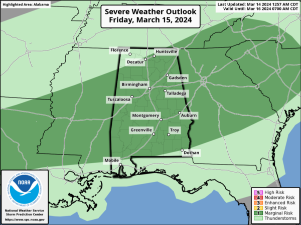
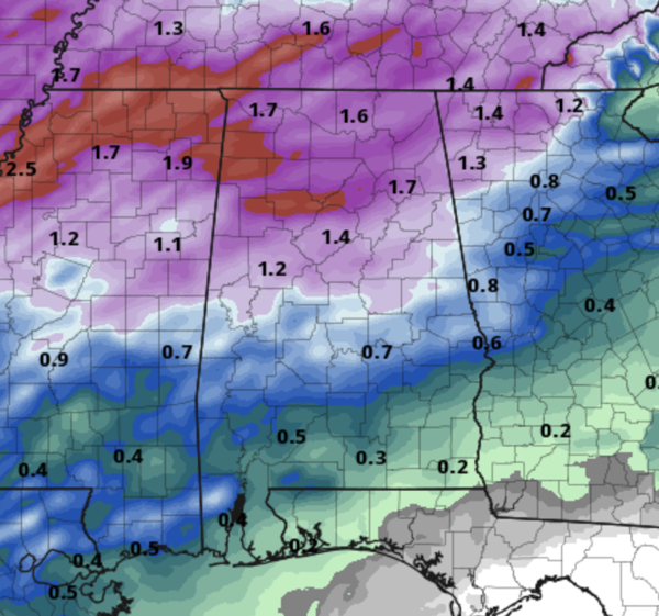
Storms will enter Northwest Alabama during the predawn hours and will drop south through the morning hours. Stronger storms will be capable of producing hail and strong, gusty winds. The tornado threat is near zero. The main window for the strong storms impacting the Interstate 20 corridor will be in the 7AM-9AM time frame. Rain amounts tomorrow will be in the 1-2 inch range for the northern half of the state, with lighter amounts to the south.
WEEKEND WEATHER: The forecast for Saturday is trending drier and for now, most of the day looks rain free, with just a few isolated showers, mostly over the southern counties. Highs Saturday will be in the 70s. Sunday will be cloudy with more scattered showers at times, highs will be in the upper 60s and lower 70s Sunday.
ANOTHER COLD SNAP: Colder air moves into Alabama Monday as a front pushes south. Highs Monday and Tuesday will be in the 50s. Tuesday morning lows will be in the upper 20s and lower 30s across the North/Central Alabama with another freeze warning likely. Again, it remains too early to be planting anything. Temperatures begin to moderate through the week and rain will likely return by either Thursday or Friday.
BEACH FORECAST CENTER: Get the latest weather and rip current forecasts for the beaches from Fort Morgan to Panama City on our Beach Forecast Center page. There, you can select the forecast of the region that you are interested in visiting.
WORLD TEMPERATURE EXTREMES: Over the last 24 hours, the highest observation outside the U.S. was 121.1F at Ventersdorp, South Africa. The lowest observation was -86.6F at Vostok, Antarctica.
CONTIGUOUS TEMPERATURE EXTREMES: Over the last 24 hours, the highest observation was 100F at Zapata and Falcon Village, TX. The lowest observation was -4F at Mackay, ID.
Category: Alabama's Weather, ALL POSTS
About the Author (Author Profile)
Macon, Georgia Television Chief Meteorologist, Birmingham native, and long time Contributor on AlabamaWX. Stormchaser. I did not choose Weather, it chose Me. College Football Fanatic. @Ryan_StinnetSubscribe
If you enjoyed this article, subscribe to receive more just like it.


