The Saturday Briefing — Showers & Breezy to Sunny Skies; Storms Return Late Monday Into Tuesday
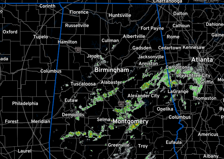
Radar Check: At 6:05 am, we have some scattered shower activity spinning around the backside of a departing low, with nearly all the activity south of the I-20 corridor. There are only a few light showers north of that, stretching from Cullman County down into Jefferson and Walker counties.
Today, we’re looking at some interesting weather changes coming our way. A cold front is on its way down from the north, bringing with it cooler air and gusty winds. This front will push any remaining showers out of our area before noon, so expect clearer skies in the afternoon. Despite the breezy conditions, the winds shouldn’t get too strong, so no need to worry about wind advisories. Temperatures will range from the low 60s to the low 70s during the day and drop quite a bit at night.
Moving on to Sunday, things will start chilly but will warm up as the day goes on. We’ll see highs in the mid 60s to low 70s, with some fair weather clouds. The humidity will be lower than usual, especially in the northeast, but it won’t last long, so there’s no red flag warning for now.
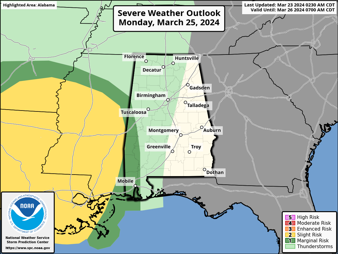
Looking ahead to Monday, a new weather system will be approaching from the west, bringing gusty winds, increased moisture, and the potential for showers and storms by Monday night into Tuesday morning. Some areas might see heavy rainfall, which could lead to flooding in low-lying spots. There’s also a small chance of severe weather in the southwest part of our area, but it should be limited.
As we move through the week, expect a frontal passage on Tuesday with rain and storms clearing out, followed by cooler and drier conditions. By mid-week, we’ll have mostly sunny skies, with temperatures ranging from the low 60s to low 70s. Towards the end of the week, we can expect more sunshine and slightly warmer temperatures, with highs in the 60s to the lower 70s.
Category: Alabama's Weather, ALL POSTS, Severe Weather, Weather Xtreme Videos
About the Author (Author Profile)
Scott Martin is an operational meteorologist, professional graphic artist, musician, husband, and father. Not only is Scott a member of the National Weather Association, but he is also the Central Alabama Chapter of the NWA president. Scott is also the co-founder of Racecast Weather, which provides forecasts for many racing series across the USA. He also supplies forecasts for the BassMaster Elite Series events including the BassMaster Classic.Subscribe
If you enjoyed this article, subscribe to receive more just like it.


