A Brief Weather Check Before 7 PM
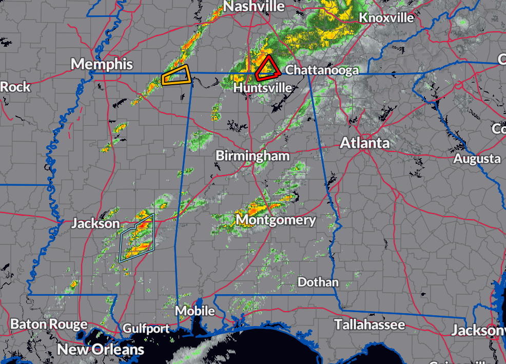
Strong to severe storms are currently impacting North Alabama, bringing significant weather hazards. Meanwhile, portions of Central Alabama are experiencing steady rain and non-severe storms. Thankfully, the rest of the region remains relatively calm.
A large batch of rain and storms along the AL/TN state line, with one embedded cell showing rotation and prompting a Tornado Warning for northern parts of Madison County until 7 PM.
Non/severe showers and storms over the southern parts of Central Alabama, with scattered showers and storms in-between.
Another line of storms has developed over Northern and Northeastern Mississippi and is expected to move into the northwest corner of North Alabama soon.
While there have been reports of trees blown down near Athens and in Leighton, there have been no reports of structural damage so far from the warned cell.
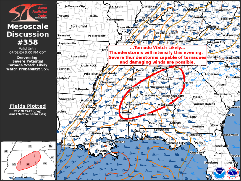
A Tornado Watch is likely to be issued soon, with a 95 percent probability of issuance. Thunderstorms are expected to increase in number through the evening, posing an elevated risk of tornadoes and damaging winds.
Category: Alabama's Weather, ALL POSTS, Severe Weather
About the Author (Author Profile)
Scott Martin is an operational meteorologist, professional graphic artist, musician, husband, and father. Not only is Scott a member of the National Weather Association, but he is also the Central Alabama Chapter of the NWA president. Scott is also the co-founder of Racecast Weather, which provides forecasts for many racing series across the USA. He also supplies forecasts for the BassMaster Elite Series events including the BassMaster Classic.Subscribe
If you enjoyed this article, subscribe to receive more just like it.


