A Brief Weather Check Before 9 PM; Severe Threat Continues
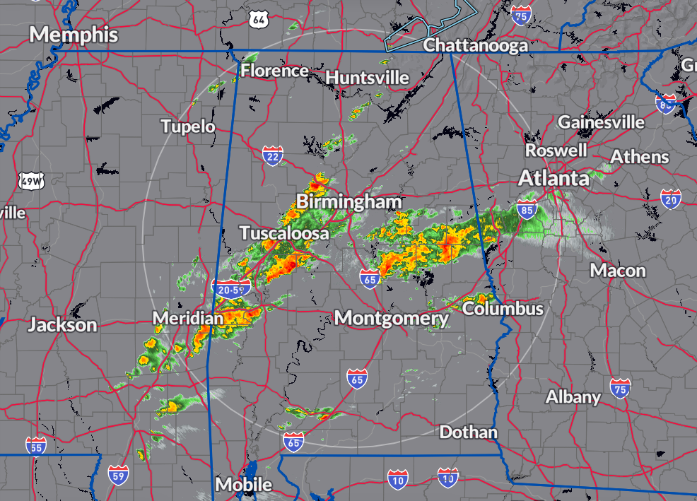
As of now, the rain and storms in North/Central Alabama are relatively well-behaved, with most of the rainfall occurring along and south of the I-20 corridor in a few clusters. There have been weak rotational signatures in a few cells over the past couple of hours, but no severe warnings are active for this region at the moment.
A Tornado Watch remains in effect until 2 AM for 33 counties in central Alabama, including Autauga, Bibb, Blount, Calhoun, Chambers, Cherokee, Chilton, Clay, Cleburne, Coosa, Dallas, Elmore, Etowah, Fayette, Greene, Hale, Jefferson, Lamar, Lowndes, Marengo, Marion, Montgomery, Perry, Pickens, Randolph, Shelby, St. Clair, Sumter, Talladega, Tallapoosa, Tuscaloosa, Walker, and Winston, as well as 4 counties in North Alabama, including Cullman, DeKalb, Jackson, and Marshall counties.
Additionally, the Tornado Watch for 7 counties in North Alabama, including Colbert, Franklin, Lauderdale, Lawrence, Limestone, Madison, and Morgan counties, has been cancelled.
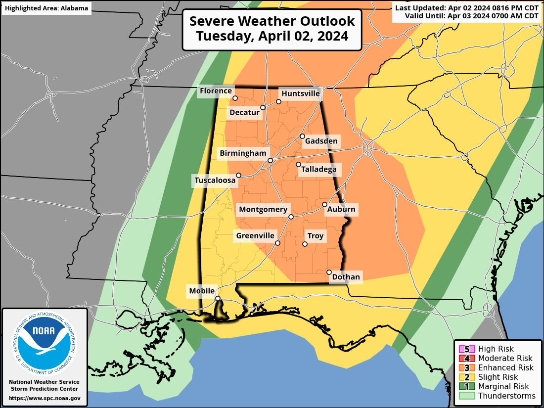
The Storm Prediction Center has continued the Enhanced Risk for severe storms for much of the state, with the rest of the state under a Slight Risk. The main threats for the remainder of the evening in these risk areas include damaging winds, tornadoes, and large hail. It’s crucial for residents in these areas to stay updated with the latest weather information and be prepared to take necessary safety precautions if severe weather occurs.
Category: Alabama's Weather, ALL POSTS, Severe Weather
About the Author (Author Profile)
Scott Martin is an operational meteorologist, professional graphic artist, musician, husband, and father. Not only is Scott a member of the National Weather Association, but he is also the Central Alabama Chapter of the NWA president. Scott is also the co-founder of Racecast Weather, which provides forecasts for many racing series across the USA. He also supplies forecasts for the BassMaster Elite Series events including the BassMaster Classic.Subscribe
If you enjoyed this article, subscribe to receive more just like it.


