Latest SPC Update: Enhanced Risk Continues for Much of North/Central Alabama
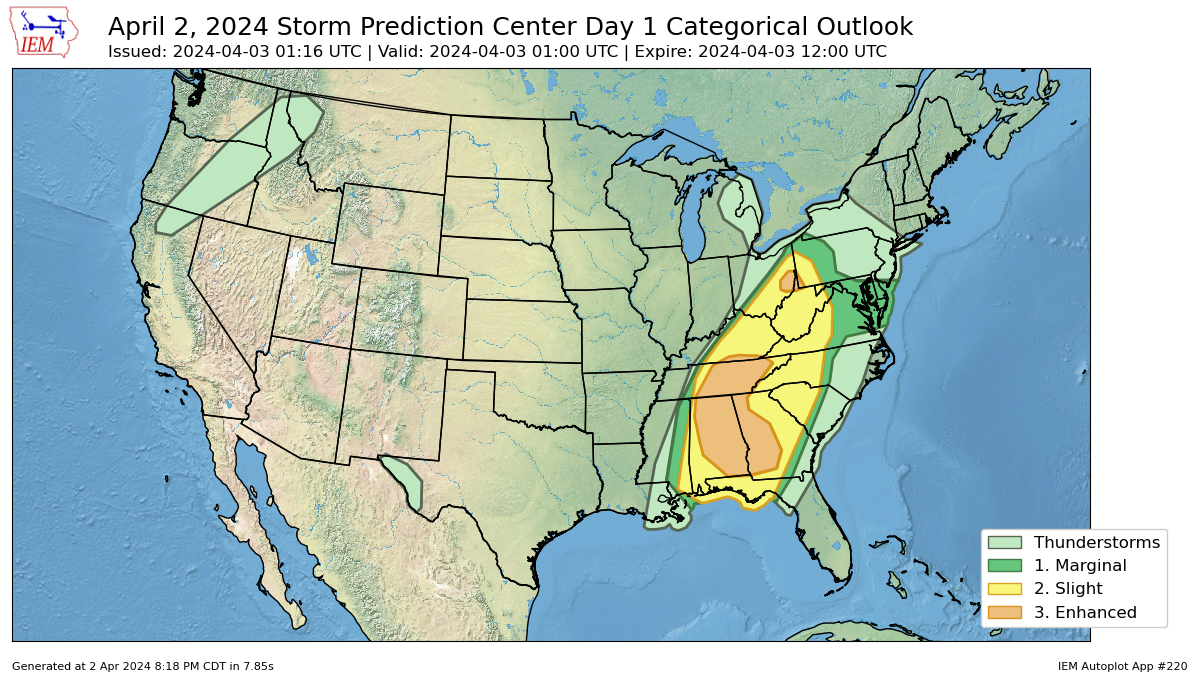
There is currently an enhanced risk of severe thunderstorms in several areas, including far eastern Ohio and portions of the Tennessee Valley and Southeastern states. Here’s a breakdown of the weather situation:
• Risk Level: Enhanced risk of severe thunderstorms.
• Regions Affected: Far eastern Ohio, Tennessee Valley, Southeastern states.
• Threats: Damaging wind gusts and tornadoes are possible.
• Current Conditions: Multiple bands of strong to severe thunderstorms are ongoing ahead of an expansive cold front stretching from the Indiana/Ohio border southwestward through central Kentucky, western Tennessee, northwest Mississippi, and central Louisiana.
• Wind Profiles: Strong wind profiles are present, supporting storm organization and the potential for damaging wind gusts and/or tornadoes.
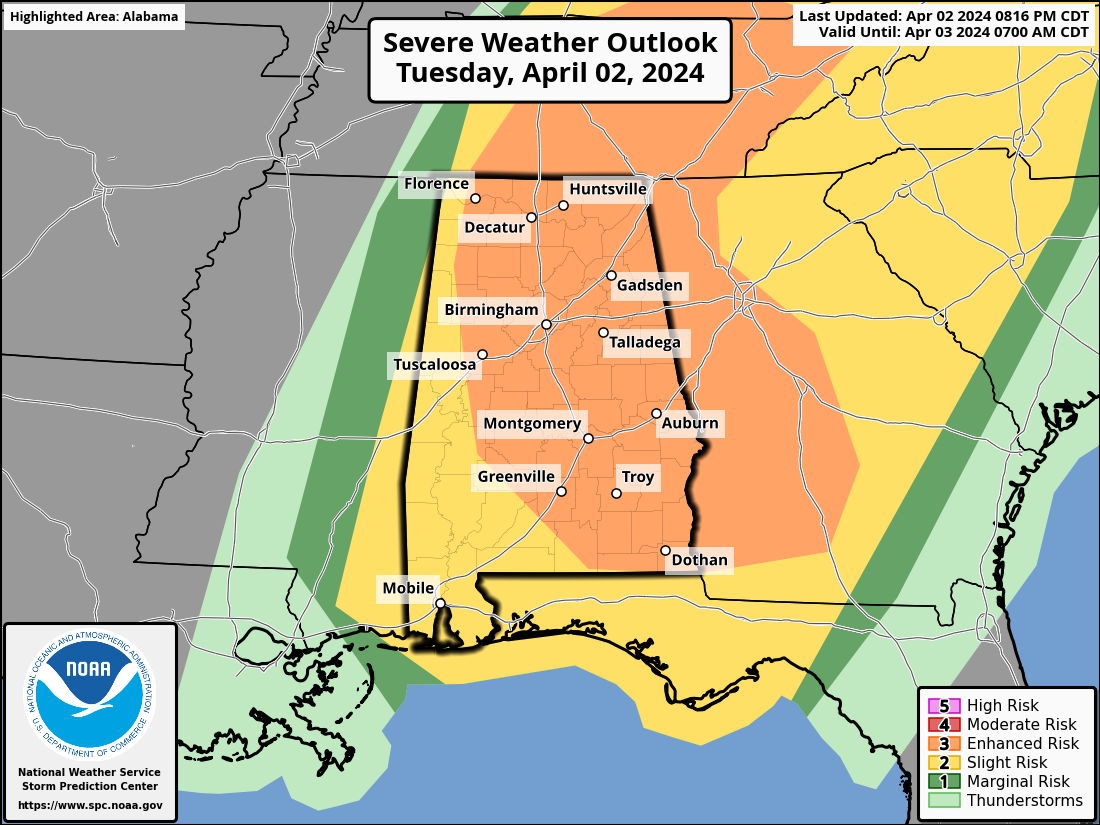
• Tennessee Valley into the Southeast: Thermodynamic conditions are somewhat favorable, especially in terms of moisture, but poor lapse rates limit overall buoyancy. Storm coverage is expected to increase, particularly across Alabama and Georgia, with damaging gusts and tornadoes possible.
• Overall, the situation calls for vigilance and preparedness for severe weather impacts such as damaging winds and possible tornadoes in the mentioned regions. Stay tuned to local weather updates and take necessary precautions if you are in these areas.
Category: Alabama's Weather, ALL POSTS, Severe Weather
About the Author (Author Profile)
Scott Martin is an operational meteorologist, professional graphic artist, musician, husband, and father. Not only is Scott a member of the National Weather Association, but he is also the Central Alabama Chapter of the NWA president. Scott is also the co-founder of Racecast Weather, which provides forecasts for many racing series across the USA. He also supplies forecasts for the BassMaster Elite Series events including the BassMaster Classic.Subscribe
If you enjoyed this article, subscribe to receive more just like it.


