Late Night Weather Update: Continuing to Monitor Severe Storm Threat in Alabama
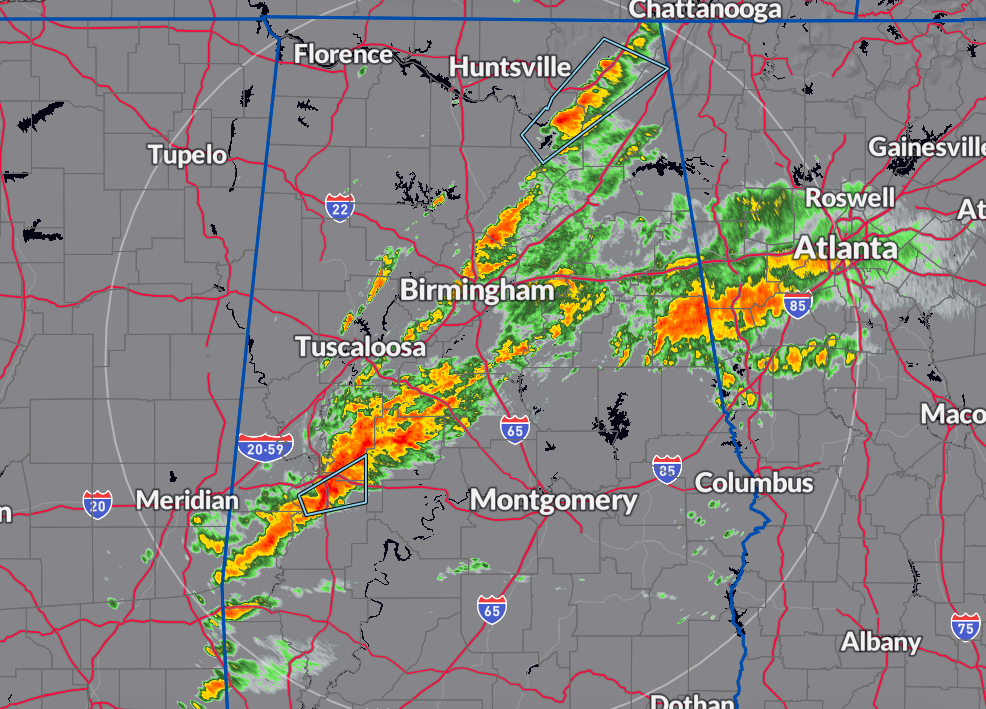
Currently, there are rain and storms happening in parts of North and Central Alabama, but none of them are too concerning right now, and there are no severe weather warnings as we head into late night. However, according to the latest HRRR model, there’s still a lot of instability in the area, especially along and south of the I-20 corridor.
This model also suggests there’s a decent chance for tornadoes in these areas, along with plenty of wind shear and helicity, which are conditions that can lead to severe storms. The possibility of rotating updrafts, which can create tornadoes, is particularly noticeable from southern Shelby County to the Georgia state line near Heflin. The dewpoints, which indicate moisture in the air, are still high, feeding into the instability.
The good news is that the National Weather Service (NWS) in Birmingham has lifted the Tornado Watch for Greene, Sumter, Tuscaloosa, and Walker counties, and NWS Huntsville has removed Cullman County from the watch list.
Remember to stay informed about the weather until the threat passes your area. Also, be prepared for cooler temperatures and strong northwesterly winds on Wednesday.
Category: Alabama's Weather, ALL POSTS, Severe Weather
About the Author (Author Profile)
Scott Martin is an operational meteorologist, professional graphic artist, musician, husband, and father. Not only is Scott a member of the National Weather Association, but he is also the Central Alabama Chapter of the NWA president. Scott is also the co-founder of Racecast Weather, which provides forecasts for many racing series across the USA. He also supplies forecasts for the BassMaster Elite Series events including the BassMaster Classic.Subscribe
If you enjoyed this article, subscribe to receive more just like it.


