Midday Nowcast: Sun, Clouds, and the Solar Eclipse
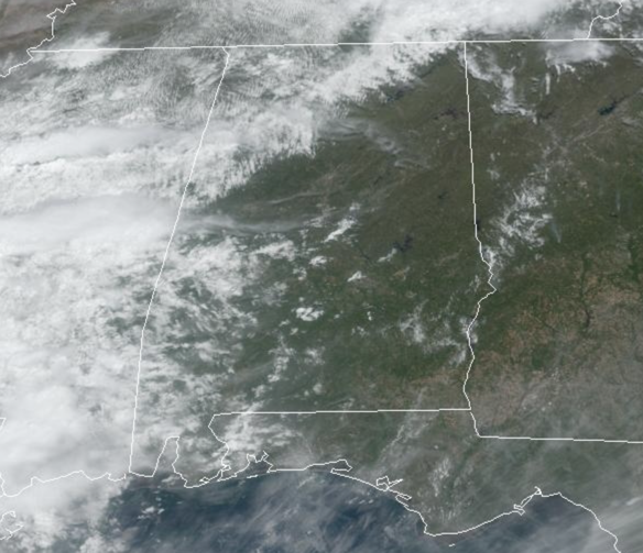
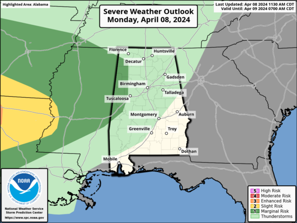
We are seeing a mix of sun and clouds today and it is a warm day with temperatures in the upper 70s and lower 80s. Expect a chance of showers, mainly for the northern and western part of Alabama. We note the SPC has an included portions of West Alabama in a “marginal risk” (level 1/5) for severe storms. Not too concerning, but a stronger storm or two could produce gusty winds later today and tonight.
TODAY’S SOLAR ECLIPSE: The path of totality is north and west of Alabama; here it will be a partial eclipse. For Alabama, it will begin around 12:45PM, peaking at 2:00PM. The eclipse is over around 3:15PM. For most of Alabama, about 80-90 percent of the sun will be blocked during the peak. However, the sky will still be bright, and most that are outside won’t notice much difference. You need to be in the path of totality for the main effect. If you choose to look at the sun (during the eclipse, or anytime), always wear the proper safety glasses (ISO 12312-2). Clouds will be thin enough over much of Alabama to see it, thicker clouds will likely be over the northern third of the state (north of Birmingham). Best chance of a mostly clear sky is over East and Southeast Alabama.
BIRMINGHAM ALMANAC: For April 8th, the average high for Birmingham is 73° and the average low is 50°. The record high is 87° set in 1967, while the record low is 29° set in 1990. We average 0.18” of precipitation on this date, and the record value is 2.86” set in 2023.
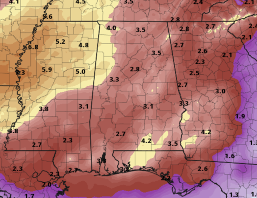
Tomorrow will feature more clouds than sun with scattered showers and storms in the forecast. The rain and storms will be over the northern half of the state, and statewide on Wednesday. The rain will be heavy at times Wednesday and Wednesday night; rain amounts between now and early Friday will be in the 2-4 inch range for much of the state with higher amounts possible. Some flooding issues are possible as well and we will likely see some flood alerts in the coming days.
Also, on Wednesday some strong to severe storms are possible and the Storm Prediction Center has all of the state in a risk of severe storms. An “enhanced risk” (level 3/5) of severe thunderstorms in place Wednesday across Southwest Alabama in the broad zone from York to Mobile. A “slight risk” (level 2/5) extends as far north as Haleyville, Birmingham, and Auburn, and the rest of the state is in a “marginal risk” (level 1/5).
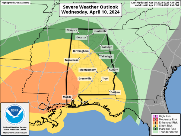
Thankfully the air should be generally rain cooled and stable; the main issue will come from strong, gusty winds. However, an isolated tornado can’t be ruled out, mainly in the “enhanced risk” area, where instability values will be higher.
THURSDAY/FRIDAY: Thursday will be a mostly cloudy, day with some risk of lingering showers over the northern half of the state. Temperatures will struggle to climb out of the 60s. Friday will feature tons of sunshine and highs near 70°.
WEEKEND & NEXT WEEK: The weekend will be warm and dry with lots of sun Saturday and Sunday along with afternoon highs around 80°. It looks like much of the week will stay warm and dry with highs exceeding 80 degrees on a daily basis. Some rain is possible toward the end of the week.
BEACH FORECAST CENTER: Get the latest weather and rip current forecasts for the beaches from Fort Morgan to Panama City on our Beach Forecast Center page. There, you can select the forecast of the region that you are interested in visiting.
WORLD TEMPERATURE EXTREMES: Over the last 24 hours, the highest observation outside the U.S. was 113.2F at Tillabery, Niger. The lowest observation was -92.4F at Dome C, Antarctica.
CONTIGUOUS TEMPERATURE EXTREMES: Over the last 24 hours, the highest observation was 91F at Rio Grande Village, TX. The lowest observation was 1F at Wolf Creek Pass and Berthoud Pass, CO.
Category: Alabama's Weather, ALL POSTS
About the Author (Author Profile)
Macon, Georgia Television Chief Meteorologist, Birmingham native, and long time Contributor on AlabamaWX. Stormchaser. I did not choose Weather, it chose Me. College Football Fanatic. @Ryan_StinnetSubscribe
If you enjoyed this article, subscribe to receive more just like it.


