

Midday Nowcast: Sun, Clouds, and Warm Temperatures
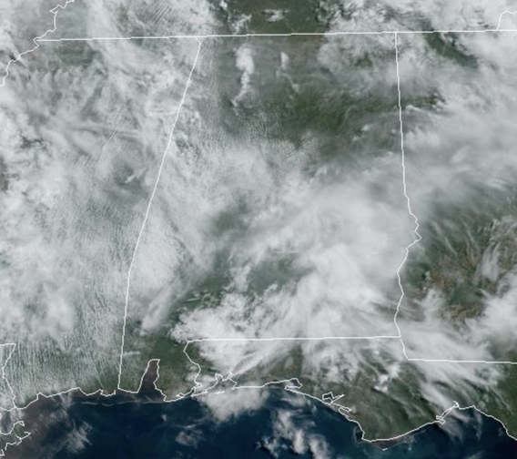
WARM DAYS: More clouds than sun today in the Alabama sky, but despite the clouds, temperatures are rising into the mid 80s across Alabama this afternoon. A few sprinkles are possible, but these will not amount to much and most locations will remain dry.
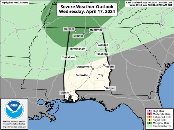
A few showers and storms are possible tomorrow afternoon and evening for the northern third of the state as a dynamic storm system passes well north of Alabama. We do note the SPC has extended a level 1 risk of severe storms into North Alabama, but we are not expecting much storm development in Alabama.
Rain amounts, where it falls, will be light. With the added clouds, we are expecting highs in the upper 70s to low 80s. Thursday will be dry with temperatures surging into the mid and upper 80s, and should be the warmest day for most of Alabama so far this year.
BIRMINGHAM ALMANAC: For April 16th, the average high for Birmingham is 75° and the average low is 52°. The record high is 89° set in 1977, while the record low is 32° set in 2014. We average 0.17” of precipitation on this date, and the record value is 4.18” set in 1900.
FRIDAY AND THE WEEKEND: A surface front will approach from the northwest, and we will bring in a chance of showers on a daily basis Friday through the weekend. Rain amounts should be generally under 1/2 inch over the these three days, and no individual day will be a wash-out. But, just understand that if you have something planned outside occasional showers are likely. The high Friday will be in the low 80s, followed by upper 70s Saturday, and upper 60s Sunday as cooler air drops into the Deep South. There could be a rumble of thunder, but no risk of severe storms Friday through Sunday.
RACE WEEKEND: The sky will be mostly cloudy at Talladega over the weekend with occasional showers both days. No way at this point to know the exact timing of the rain, but just understand delays will be possible for the races Saturday, and the Geico 500 Sunday. No wash-out, but be ready for some rain at times. The high Saturday will be in the mid 70s, followed by mid 60s Sunday as cooler air arrives. Some thunder can’t be ruled out, but there is no risk of severe storms, and rain amounts should be fairly light.
NEXT WEEK: Most of the week will be dry with a warming trend; the high will be close to 80 by Wednesday. Still no sign of any high impact weather event (severe storms, flooding) for at least the next 7-10 days for Alabama.
BEACH FORECAST CENTER: Get the latest weather and rip current forecasts for the beaches from Fort Morgan to Panama City on our Beach Forecast Center page. There, you can select the forecast of the region that you are interested in visiting.
WORLD TEMPERATURE EXTREMES: Over the last 24 hours, the highest observation outside the U.S. was 113.4F at Chauk, Myanmar. The lowest observation was -95.8F at Vostok, Antarctica.
CONTIGUOUS TEMPERATURE EXTREMES: Over the last 24 hours, the highest observation was 111F at Rio Grande Village, TX. The lowest observation was 14F at Berthoud Pass, CO.
Category: Alabama's Weather, ALL POSTS
About the Author (Author Profile)
Macon, Georgia Television Chief Meteorologist, Birmingham native, and long time Contributor on AlabamaWX. Stormchaser. I did not choose Weather, it chose Me. College Football Fanatic. @Ryan_StinnetSubscribe
If you enjoyed this article, subscribe to receive more just like it.


