

Showers End Tonight; Mostly Dry Tomorrow
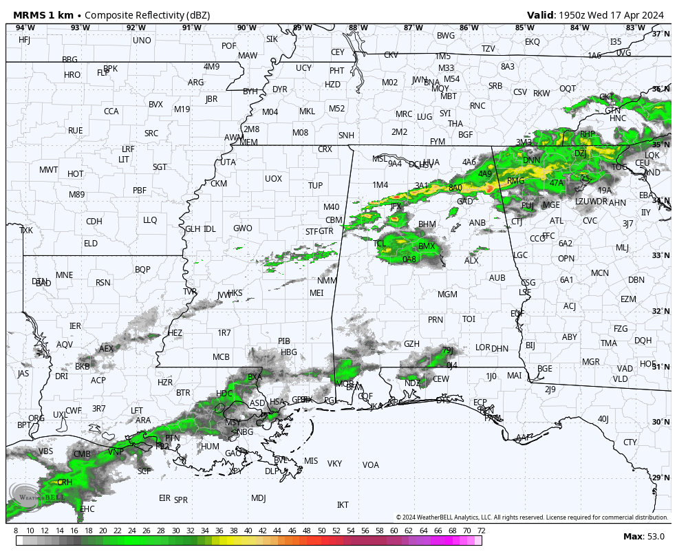
RADAR CHECK: Showers continue to move over the northern half of Alabama this afternoon along with a few thunderstorms. The sky is mostly cloudy, with the exception of the southeast counties of the state where the sun is out. Temperatures range from the upper 60s over North Alabama to the mid 80s around Dothan. Showers will end tonight; the sky will stay mostly cloudy.
Tomorrow should be the warmest day of the week with a high in the 83-87 degree range. The day will feature a mix of sun and clouds, and a few showers could reach the northwest part of the state by late afternoon. Showers and a few thunderstorms are possible tomorrow night ahead of another front.
FRIDAY AND THE WEEKEND: We will mention a chance of widely scattered showers and possibly a thunderstorm Friday, but a decent part of the day should be dry with a high in the low 80s. The front will sag southward over the weekend, and moisture will ride up and over the cool air behind the front, meaning periods of rain both Saturday and Sunday. There could be a rumble of thunder, but no risk of severe storms, and rain amounts should be mostly 1/2 inch or less. It looks like the most widespread rain will be on Sunday.
There will be some breaks in the rain, and the weekend won’t be a total wash-out. Temperatures will trend cooler; the high Saturday will be in the 70s, and then on Sunday many communities across North Alabama will have a hard time getting out of the 50s.
NEXT WEEK: At this point most of next week looks dry with a warming trend; afternoon temperatures will be back in the low 80s degrees over the latter half of the week. See the video briefing for maps, graphics, and more details.
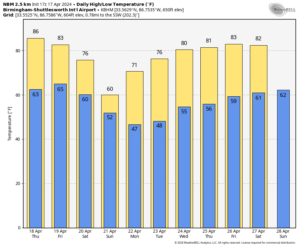
RACE WEEKEND: The weekend will be cloudy and wet at times at the Talladega Superspeedway. Off and on showers are likely Saturday, but it won’t rain all day; the high will be in the mid 70s. Rain should be more widespread Sunday, but it won’t rain all day and there is still some hope they get the Geico 500 in. Sunday will be very cool with a high close to 60 degrees with a cool north breeze. No risk of severe storms, and the rain should be generally 1/2 inch or less over the weekend.
ON THIS DATE IN 2002: A heat wave continued across the eastern U.S. as high pressure off the Carolina blocked a frontal boundary across the Plains. Newark, NY recorded a high of 97 degrees; New York City reached 96.
Look for the next video briefing here by 6:00 a.m. tomorrow…
Category: Alabama's Weather, ALL POSTS, Weather Xtreme Videos
About the Author (Author Profile)
James Spann is one of the most recognized and trusted television meteorologists in the industry. He holds the AMS CCM designation and television seals from the AMS and NWA. He is a past winner of the Broadcast Meteorologist of the Year from both professional organizations.Subscribe
If you enjoyed this article, subscribe to receive more just like it.


