

Summer-Like Weather Today; Stormy Thursday To Follow
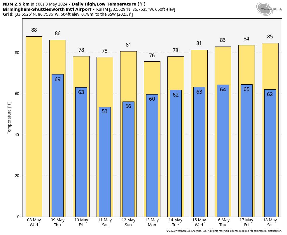
LIKE SUMMER: We project a high in the 87-91 degree range across Alabama today with a mix of sun and clouds. A few isolated showers or storms could pop up this afternoon and early tonight, but many places will be dry.
STORMY THURSDAY: An organized batch of thunderstorms will move into the Tennessee Valley of North Alabama after midnight tonight… it will drift southward through the morning hours. These storms will be capable of producing strong winds and some hail; they will reach the I-59/20 corridor (Birmingham, Tuscaloosa, Anniston, Gadsden) around mid-morning. Then, by afternoon, the storms will be mainly over South Alabama.
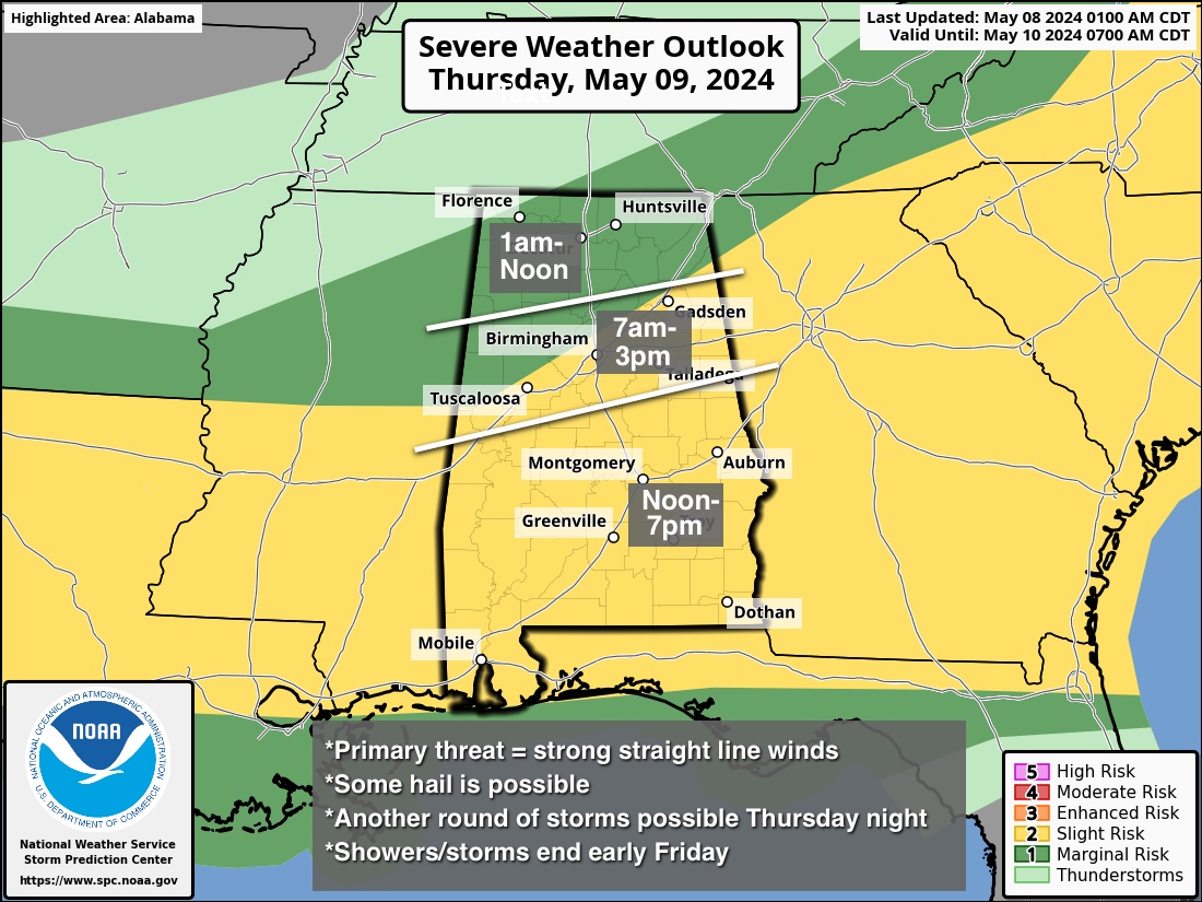
More showers and storms could develop late tomorrow and tomorrow night as a cold front pushes into the state; small hail and gusty winds will be possible, but the overall severe weather threat with this activity is not especially high since the air will be worked over by the rain earlier in the day.
Noticeably cooler air moves into North Alabama Friday with a clearing sky; a few showers and storms are still possible Friday morning over the southern counties of the state. That rain should be over by early afternoon, and the cooler air will cover the entire state by Friday night as the sky becomes mostly clear statewide.
THE ALABAMA WEEKEND: Saturday will be a beautiful day with ample sunshine along with a high in the 77-82 degree range after starting the day in the 50s. Some colder spots could see upper 40s over North Alabama early Saturday morning. Expect a partly sunny sky Sunday with a high close to 80 degrees for most places.
NEXT WEEK: We will bring in a chance of showers Monday as moisture levels rise, and a few showers or storms are likely Tuesday. The rest of the week is looking relatively unsettled with some risk of rain or thunderstorms on most days… See the video briefing for maps, graphics, and more details.
ON THIS DATE IN 1979: Widespread damage occurred in the Tampa Bay area. The 19 tornadoes reported are the most in one day in Florida history. Three people drowned in Pinellas County where flooding was most severe. Rainfall amounts of 18 inches in 24 hours were reported with 12.73 inches falling at Tampa; with 7.84 inches of that in just six hours. Worst hit was the Polk County community of Auburndale where a tornado made a direct hit on the Auburndale School. Flying debris hurt only eight students.
ON THIS DATE IN 2003: This was the second of three consecutive days with strong to violent tornadoes around Oklahoma City. A violent F4 tornado that affected Moore, Oklahoma City, Midwest City and Choctaw took on a path very similar to the 5/3/1999 devastating tornado.
Look for the next video briefing here by 3:00 this afternoon… enjoy the day!
Category: Alabama's Weather, ALL POSTS, Weather Xtreme Videos
About the Author (Author Profile)
James Spann is one of the most recognized and trusted television meteorologists in the industry. He holds the AMS CCM designation and television seals from the AMS and NWA. He is a past winner of the Broadcast Meteorologist of the Year from both professional organizations.Subscribe
If you enjoyed this article, subscribe to receive more just like it.


