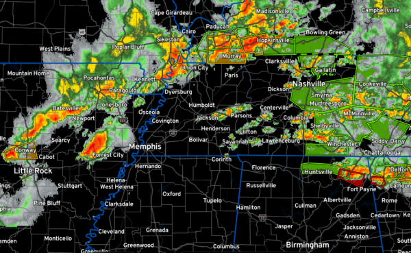
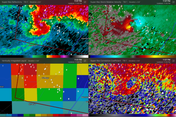
Alabama Update at 1145 pm: Second Storm Moving Toward Scottsboro/Henagar Areas
It was been a long and dangerous evening across North Alabama. Several tornadoes have been reported from across the Tennessee Valley, including a damaging one in Huntsville and another in Jackson County from Scottsboro to Henagar. There are concerning reports of some pretty bad damage in the Henagar area, with mobile homes overturned and residents trapped.
Another supercell east of Huntsville is going to move over the same area. We need to let first responders and residents know that a second severe storm and possible tornado is coming to areas that have already been hit.
The good news is that there seems to be a break behind the current supercell that is east of Huntsville.
There is widespread rain and thunderstorms over Middle and Eastern Tennessee. There are numerous reports of flooding and flash flood warnings are in effect.
More storms will continue near the Alabama Tennessee border through 2 a.m. or so
A line of storms will start moving southeastward through western Tennessee over the next couple of hours. This activity is expected to slowly sink into Alabama during the pre-dawn hours. It could be severe with damaging winds the primary threat. But hail and a tornado or two is possisble.
The severe weather threat will continue into the afternoon hours and the storms drop southward.
More storms will occur Thursday evening into Friday morning over southern portions of the area. Some of those storms will be severe as well. Damagign winds, hail, and a tornado or two are possible with this event.
Category: Alabama's Weather, ALL POSTS, Severe Weather


