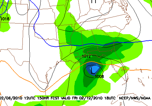
Finally our turn?
More details later…but the GFS and now the European and Canadian models are all showing snow for north Alabama Friday, maybe as far south as Montgomery. With El Nino providing lots of precipitation, and an AO that keeps going negative and allowing cold air to move south, it’s surprising we’ve gone this long without a snow event. They’ve happened already in Oklahoma (twice), Arkansas, Tennessee, North Carolina, and even in south Texas this winter.
It will remain cold for the next week or so, with temperatures briefly warming up Monday (50s) ahead of the next rain event on Tuesday. It will turn cold again Wednesday and Thursday, and then we may have precipitation on Friday, in the form of snow. It’s still 6 days away, but for this far out, the model agreement suggests at least some confidence.
The persistence of below normal temperatures this year is noteworthy also. In a normal winter (Dec-Feb), we have 25 days with highs below 50 degrees. We’ve already had 31 so far this winter (counting today), with probably at least 4 or 5 coming in the next week. The most we’ve ever had was in the winter of 1970-71 (51 days with highs below 50). So, in another category, this winter is one of our coldest ever in BHM. The water temperature at the Warrior River the other day was still 48. Wow.
Category: Uncategorized


